Crystal City, Virginia facts for kids
Quick facts for kids
Crystal City, Arlington, Virginia
|
|
|---|---|
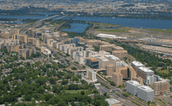
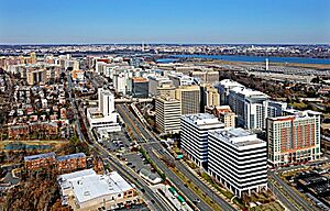
Aerial view of Crystal City (foreground) and the Potomac River and Washington, D.C. (background) in September 2020
|
|
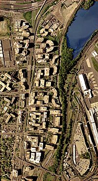
Satellite image of Crystal City with U.S. Route 1 (left); Reagan National Airport (bottom right); George Washington Memorial Parkway (center); I-395 (top left); and VA Route 233/Airport Viaduct (bottom) in 2002
|
|
| Country | |
| State | |
| County | |
| Population
(2010)
|
|
| • Total | 22,543 |
| Time zone | UTC−5 (EST) |
| • Summer (DST) | UTC−4 (EDT) |
| ZIP Code |
22202
|
| Area codes | 703, 571 |
Crystal City is a busy neighborhood in Arlington County, Virginia. It's located about 5 miles south of Downtown Washington, D.C..
One cool thing about Crystal City is its underground tunnels. You can walk between many offices, homes, and shops without going outside! This makes parts of Crystal City feel like an underground city.
Many important companies and organizations are in Crystal City. These include aerospace and defense companies, government offices like the U.S. Department of Labor, and the national headquarters for PBS.
Ronald Reagan Washington National Airport is also located in Crystal City. It's the busiest airport in the Washington metropolitan area. In 2022, over 11 million passengers used this airport.
Contents
Exploring Crystal City
Crystal City is built along U.S. Route 1, also called Richmond Highway. It's just south of the Pentagon and close to Ronald Reagan Washington National Airport.
Arlington County calls Crystal City an "urban village." This means it's a lively area with lots of tall apartment buildings, offices, hotels, and places to eat and shop. The neighborhood is famous for its large network of underground shopping areas and connecting tunnels.
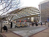
You can easily get around Crystal City using public transport. It has a station for the Washington Metro's Blue and Yellow Lines. There's also a station for the Virginia Railway Express commuter train.
When Crystal City was first built in 1963, its design was very modern. It had large blocks of buildings with special roads for cars. People were meant to walk in underground tunnels. Over time, Crystal City has been updated. Now, it has more restaurants at street level. The roads have also changed to feel more like regular city streets.
A Look at Crystal City's Past
How Crystal City Began
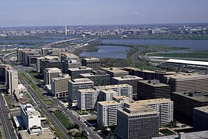
Before Crystal City was developed, the area had small factories and motels. These were near National Airport. There was even a drive-in movie theater from 1947 to 1963. Train tracks were moved to make more space for new buildings.
Construction started in 1963. The first building was called Crystal House. It had a fancy crystal chandelier in its lobby. Because of this, all the new buildings were named "Crystal" something, like Crystal Gateway and Crystal Towers. This is how the whole area got its name, "Crystal City." Most of the tall buildings in Crystal City have speckled granite on the outside.
The Crystal Underground shopping mall opened in September 1976. It was designed to look like an old-fashioned shopping village. It had antique glass windows and cobblestone "streets." The mall focused on small, local shops. It also had a food court called the Crystal Palace.
Crystal City Today
Since 2004, Crystal City has seen many changes. Some building addresses were updated. Major roads became two-way streets. Many old building names were removed, which can sometimes make it hard for visitors to find places.
In 2010, Arlington County created a plan for Crystal City's future. This plan aimed to make Crystal City more welcoming and lively. It focused on adding more shops at street level, better offices, and more housing. This long-term plan helped Crystal City become a better place to live and work.
Crystal City's Economy
Crystal City is home to over 22,000 people. On weekdays, about 60,000 people come to work there.
The headquarters of the U.S. Marshals Service is in Crystal City. Many Department of Defense offices are also located here. These include offices for the Pentagon.
Years ago, US Airways had its main office in Crystal City. But after it merged with another airline in 2005, the headquarters moved to Arizona.
Today, many other important companies and groups have their main offices in Crystal City. These include Boeing, Bloomberg Industry Group, the American Diabetes Association, PBS, and the Consumer Technology Association.
Amazon's New Headquarters
On November 13, 2018, Amazon.com announced exciting news. Crystal City would be one of the locations for its new headquarters, called Amazon HQ2. The other location was planned for New York City. Both places were expected to create about 25,000 jobs.
Amazon worked with local officials to market the area. They decided to call the combined area of Crystal City, part of Pentagon City, and Potomac Yard "National Landing". In February 2019, Amazon decided to focus only on the Crystal City location for HQ2. Construction for this new headquarters is currently underway.
-
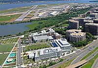
Boeing's global headquarters at Reagan National Airport
-
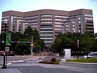
Crystal Park Four, a high-rise building that once served as the headquarters for US Airways


