
Cunningham, Kansas facts for kids
Quick facts for kids
Cunningham, Kansas
|
|
|---|---|

U.S. Post Office (2009)
|
|

Location within Kingman County and Kansas
|
|

|
|
| Country | United States |
| State | Kansas |
| County | Kingman |
| Founded | 1880s |
| Incorporated | 1908 |
| Named for | J.D. Cunningham |
| Area | |
| • Total | 0.47 sq mi (1.21 km2) |
| • Land | 0.47 sq mi (1.21 km2) |
| • Water | 0.00 sq mi (0.00 km2) |
| Elevation | 1,709 ft (521 m) |
| Population
(2020)
|
|
| • Total | 444 |
| • Density | 945/sq mi (366.9/km2) |
| Time zone | UTC-6 (CST) |
| • Summer (DST) | UTC-5 (CDT) |
| ZIP code |
67035
|
| Area code | 620 |
| FIPS code | 20-16775 |
| GNIS ID | 2393696 |
Cunningham is a small city in Kingman County, Kansas, United States. It was named after J.D. Cunningham, an early settler in the area. In 2020, about 444 people lived there.
Contents
History of Cunningham
The story of Cunningham began with an older town called Ninnescah. This town was located near the Ninnescah River and shared its name. Ninnescah had its own post office starting in 1885.
A few years later, the town of Cunningham was started a bit to the west, right next to the railroad tracks. People in Ninnescah decided to move their town to Cunningham. Many buildings were actually picked up and moved in 1887 and 1888! A big tornado hit Ninnescah on March 24, 1888, which sadly destroyed most of what was left. This event helped Cunningham become the main town. Cunningham officially became a city in 1908.
Where is Cunningham?
Cunningham is located in Kingman County, Kansas. The city covers a total area of about 0.35 square miles (0.91 square kilometers), and all of it is land.
People in Cunningham
| Historical population | |||
|---|---|---|---|
| Census | Pop. | %± | |
| 1910 | 395 | — | |
| 1920 | 462 | 17.0% | |
| 1930 | 412 | −10.8% | |
| 1940 | 451 | 9.5% | |
| 1950 | 510 | 13.1% | |
| 1960 | 618 | 21.2% | |
| 1970 | 483 | −21.8% | |
| 1980 | 540 | 11.8% | |
| 1990 | 535 | −0.9% | |
| 2000 | 514 | −3.9% | |
| 2010 | 454 | −11.7% | |
| 2020 | 444 | −2.2% | |
| U.S. Decennial Census | |||
2020 Population Details
In 2020, the 2020 United States census counted 444 people living in Cunningham. There were 180 households and 111 families. About 22% of the households had children under 18. Many households (51.7%) were married couples living together. The average household had 2.3 people.
About 19.8% of the people were under 18 years old. About 32.2% were 65 years or older. The average age in Cunningham was 52.3 years.
2010 Population Details
The census in 2010 showed that 454 people lived in Cunningham. There were 183 households. About 22.4% of these households had children under 18. The average household size was 2.14 people.
The median age in the city was 50.7 years. About 18.1% of residents were under 18. About 29.1% were 65 years or older.
Schools and Learning
The public schools in Cunningham are part of the Cunningham–West Kingman County USD 332 school district.
- Cunningham High School
- Cunningham Grade School
The Cunningham Wildcats, which is the high school's team, won the Kansas State High School boys class 1A Track & Field championship in 2008.
The city also has a public library where you can find books and learn new things.
- Cunningham Public Library
Getting Around

U.S. Route 54 is a main road that goes right through Cunningham.
Gallery
-
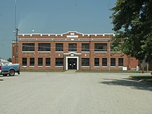
Cunningham High School, 100 West Fourth St (2009)
-
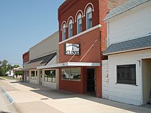
Cunningham Clinic, 120 North Main St (2009)


See also
 In Spanish: Cunningham (Kansas) para niños
