
Currie facts for kids
Quick facts for kids Currie
|
|
|---|---|
 The Flag of Currie |
|
 The Coat of Arms of Currie |
|

Currie
|
|
| Population | 7,494 (2011) |
| OS grid reference | NT182677 |
| Council area |
|
| Country | Scotland |
| Sovereign state | United Kingdom |
| Post town | CURRIE |
| Postcode district | EH14 |
| Dialling code | 0131 |
| Ambulance | Scottish |
| EU Parliament | Scotland |
| UK Parliament |
|
| Scottish Parliament |
|
Currie is a village and suburb located on the edge of Edinburgh, Scotland. It's about 7 miles (11 km) southwest of the city centre. Currie used to be part of Midlothian county. Now, it is managed by the City of Edinburgh Council. You can find it between Juniper Green to the northeast and Balerno to the southwest. Currie also gives its name to a civil parish, which is an old type of local area.
In 2001, about 8,550 people lived in Currie. There were also 3,454 houses in the area.
Contents
What's in a Name?
The name Currie has been written in different ways since 1210. Some old spellings include Curey, Cory, and Curri. The name Currie became common around 1402.
No one is completely sure where the name Currie comes from. It might come from a Scottish Gaelic word, curagh or curragh. This word means a wet or boggy plain. Another idea is that it comes from a Brythonic word, curi. This word means a dell or a dirt hole. Both are possible because nearby places have names from these languages. For example, Balerno comes from Gaelic, and the Pentland Hills come from Brythonic.
Currie's Past
Early History
The oldest signs of people living in Currie are from the Bronze Age. A razor from about 1800 BC was found at Kinleith Mill. Stone cists, which are ancient burial boxes, from 500 BC were found at Duncan's Belt and Blinkbonny. These show that people lived here a very long time ago.
Currie is mentioned in old documents from the mediaeval and early modern times. In 1249, Robert of Kildeleith became Chancellor of Scotland. Kildeleith means "Chapel by the Leith," and that area is now called Kinleith.
Growing as a Village
Robert the Bruce gave Riccarton as a wedding gift in 1315. Later, in 1392, the land went to the family of Bishop Wardlaw. Over time, the land changed hands many times.
A Christian community has been in Currie for over 1,000 years. In 1018, church leaders set up their main office here. By the 13th century, Currie was known as a favourite hunting spot for the Lords and Knights of Edinburgh Castle. The village started to grow around Currie Kirk (church) and the main Lanark Road. This road was the main route south and is still known as 'The Lang Whang'.
Famous People and Changes
The poet James Thomson grew up in Currie in the late 1700s. A part of the Kinleith Burn is called the "Poet's Glen" in his memory. Some streets in Currie are also named after him.
A war memorial was put up in 1919. It was designed by a famous architect, Sir Robert Lorimer.
Between 1921 and 1951, Currie changed a lot. More houses were built, both council houses and private homes. In the late 1950s and early 1960s, many new houses were built north of Lanark Road West. Currie became a popular place for people to live and travel to Edinburgh for work.
Currie High School was built in 1966 and updated in 1997. There used to be a train station on a short railway line. This line is now the Water of Leith Walkway. The old part of Currie, south of Lanark Road West, has stayed mostly the same. In 1972, the historic centre of Currie was made a Conservation Area. This means it is protected to keep its special character.
Learning in Currie
Early Schools
The first record of education in Currie is from 1598. The Edinburgh Town Council sent someone to help choose a schoolmaster for the village. In 1694, a Mr Thomson was hired to teach in the church. A school building and a house for the schoolmaster were built in 1699. The school cost 500 merks, and the teacher earned 20 pounds Scots each year.
Modern Schools
Currie has several schools today. Currie High School is one of them. It has been a Green Flag Eco-School since 2004, meaning it focuses on environmental education. There is also Nether Currie Primary School and Currie Primary School. Currie Primary was formed in 2005 when Curriehill Primary and Riccarton Primary School joined together.
Since the 1970s, Heriot-Watt University has moved its main campus to Currie. It used to be in the city centre. The university now has a large, wooded campus with space to grow.
Sports in Currie
Football
Currie has one youth football team called Currie Football Club. Another team, Currie Star Football Club, plays its games in the Kingsknowe area of Edinburgh.
Rugby
Currie has a rugby team called Currie RFC. They play their home games in the nearby village of Balerno.
Fun and Culture
Currie has two Scout Groups: the 31st Pentland, which has been active since 1924, and the 42nd Pentland.
Currie is also a District for Girlguiding Edinburgh. The 1st Currie Guides have been running since 1921. The 1st Currie Brownies have been active since 1933.
Every year, on the first Saturday of May, the Currie Riding of the Marches takes place. This is a traditional event.
Local History
The Currie and District Local History Society meets regularly. They invite speakers to talk about different parts of the area's history. The society meets on the first and third Monday of each month, starting in October. Their meetings are held at the Gibson Craig Hall on Lanark Road in Currie.
Who Lives Here?
This table shows the different groups of people living in Currie compared to Edinburgh as a whole:
| Ethnicity | Currie | Edinburgh |
|---|---|---|
| White | 92.6% | 91.7% |
| Asian | 3.8% | 5.5% |
| Black | 2.3% | 1.2% |
| Mixed | 0.5% | 0.9% |
| Other | 0.8% | 0.8% |
Getting Around
The A70 runs through Currie. You can catch the 44 and 45 bus routes, run by Lothian Buses, to get around. Currie also has a train station, Curriehill railway station, on the line that goes between Glasgow and Edinburgh.
Currie is close to the City of Edinburgh bypass. The Union Canal is to the north, and the Water of Leith is to the south. Edinburgh Airport is about 4 miles (6 km) north of Currie. The M8 motorway, which goes to Glasgow, is about 2 miles (3 km) north. You can also get to Livingston in West Lothian using the E&M Horsburgh service 24 bus.
Currie Kirk


The church in Currie, known as Currie Kirk, was originally dedicated to St Mungo. It was controlled by the Archdeaconry of Lothian before the Reformation.
The church building you see today was built in 1784 by James Thompson. It has a simple rectangular shape with a low central spire. Inside, it was updated in 1835 by architect David Bryce. In 1848, the windows were made larger by David Cousin. The graveyard around the church is older than the current building, so it's likely there was an earlier church here.
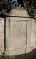
The graveyard has three parts. The oldest part is around the church and has interesting carved stones from the 1600s and 1700s. There's also a Victorian section and a newer cemetery. One special stone is shaped like a coffin and dates back to 1751.
The war memorial near the church entrance looks like an old medieval market cross. It was designed by Sir Robert Lorimer and added in 1921. Below the church, near the Water of Leith, is St Mungo's Holy Well. It has a stone basin and side walls.
Famous People from Currie
Many interesting people have lived in Currie, including:
- Stephen Carter, Baron Carter of Barnes - A politician.
- Jamie Dick - A Youth Olympic Gold Medalist in Curling.
- Kate Green - A Labour Member of Parliament (MP).
- Dougal Haston - A pioneer in Scottish mountaineering.
- John Henry Maitland Moir - A leader in the Greek Orthodox Church.
- Rev Alexander Ranken - Born and raised in Currie.
- Peter Sawkins - The winner of Series 11 of The Great British Bake Off.
- Matt Scott - A Scottish international Rugby Union player.
- James Thomson (weaver poet) - A weaver and poet.
- Paul Research and John Mackie - Members of the post-punk band The Scars.
Images for kids
-
The grave of Rev James Dick, Currie churchyard

