Cypress Branch (St. Jones River tributary) facts for kids
Quick facts for kids Cypress Branch |
|
|---|---|
|
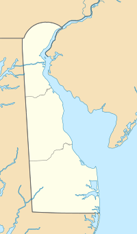
Location of Cypress Branch mouth
|
|
| Other name(s) | Tributary to St. Jones River |
| Country | United States |
| State | Delaware |
| County | Kent |
| Physical characteristics | |
| Main source | Tidbury Creek divide Whispering Pines, Delaware 25 ft (7.6 m) 39°09′20″N 075°30′44″W / 39.15556°N 75.51222°W |
| River mouth | St. Jones River about 1 mile south of Dover, Delaware 0 ft (0 m) 39°06′05″N 075°28′16″W / 39.10139°N 75.47111°W |
| Length | 2.81 mi (4.52 km) |
| Basin features | |
| Progression | generally northeast |
| River system | St. Jones River |
| Basin size | 2.91 square miles (7.5 km2) |
| Tributaries |
|
| Bridges | South State Street, Cypress Branch Road |
Cypress Branch is a small stream, about 2.81 miles (4.52 km) long. It's like a smaller river that flows into a bigger one. This stream is located in Kent County, Delaware. It's considered a "first-order" tributary, meaning it's one of the smallest streams that doesn't have other streams flowing into it before it joins a larger river.
Where Cypress Branch Starts and Ends
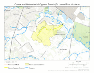
Cypress Branch begins in an area called Whispering Pines in Kent County, Delaware. It starts near a natural boundary that separates water flowing into Cypress Branch from water flowing into Tidbury Creek.
From its starting point, Cypress Branch flows mostly towards the northeast. After its journey, it joins the St. Jones River. This meeting point is about 1 mile (1.6 km) south of the city of Dover, Delaware.
The Cypress Branch Watershed
The land area that drains water into Cypress Branch is called its watershed. This watershed covers about 1.63 square miles (4.22 square kilometers). This means all the rain and snow that falls on this area eventually flows into Cypress Branch.
On average, the watershed receives about 44.8 inches (113.8 cm) of rain each year. A "topographic wetness index" of 604.28 helps scientists understand how wet the soil is in the area. A higher number means the ground tends to be wetter. About 1.2% of this watershed is covered by forests.
Maps of Cypress Branch
 | Toni Morrison |
 | Barack Obama |
 | Martin Luther King Jr. |
 | Ralph Bunche |


