
Dauphin Lake facts for kids
Quick facts for kids Dauphin Lake |
|
|---|---|

Dauphin Lake
Location in Manitoba
|
|
-001.jpg)
Dauphin Lake is west of Lake Manitoba
|
|
| Location | Manitoba |
| Coordinates | 51°15′N 99°45′W / 51.250°N 99.750°W |
| Primary outflows | Mossy River (to Lake Winnipegosis) |
| Catchment area | 8,870 km2 (3,420 sq mi) |
| Basin countries | Canada |
| Surface area | 521 km2 (201 sq mi) |
| Average depth | 2.4 m (7 ft 10 in) |
| Max. depth | 3.4 m (11 ft) |
| Water volume | 1.29 km3 (1,050,000 acre⋅ft) |
| Residence time | 3.55 years |
| Shore length1 | 190 km (120 mi) |
| Surface elevation | 260.4 m (854 ft) |
| 1 Shore length is not a well-defined measure. | |
Dauphin Lake is a large lake in western Manitoba, Canada. It is located close to the city of Dauphin, Manitoba. The lake covers an area of about 521 square kilometers (201 square miles).
The lake's water comes from a large area around it, called a drainage basin. This basin is about 8,870 square kilometers (3,420 square miles) in size. The Mossy River flows out of Dauphin Lake and carries its water to Lake Winnipegosis.
Dauphin Lake is a great place for fun activities. Many people enjoy fishing there all year round. You can also go camping along its shores. Lots of families have cottages near the lake for holidays.
The lake got its name from the Dauphin of France in 1739. The Dauphin was the title for the person who would become the next king of France. A French explorer named Francois de La Verendrye gave it this name.

Contents
Where is Dauphin Lake Located?
Dauphin Lake sits west of Lake Manitoba. It is also south of Lake Winnipegosis. Most of the water flowing into Dauphin Lake comes from the west.
How is Dauphin Lake's Water Level Managed?
People have tried to control the lake's water levels for many years. This helps prevent floods or very low water.
What is the Mossy River Dam?
In 1964, the Mossy River Dam was built. It is located where the Mossy River leaves the lake. This dam has ten sections with concrete logs that can be moved. It also has a special "fish ladder" to help fish swim past it. The government of Manitoba operates this dam.
Since 1993, the goal for the lake's water level in summer has been 260.54 meters (854.8 feet). The dam can hold back water when the lake is low and dry. However, when there is a lot of rain, the Mossy River can only let out a certain amount of water. This makes it hard to control the lake perfectly.
For example, in June 1947, a four-day rain caused a huge amount of water to flow into the lake. The river could only drain a small part of that water. This shows how quickly conditions can change.
What Rivers Flow into Dauphin Lake?
Many rivers and creeks bring water into Dauphin Lake. These are called tributaries. Some of the main ones include:
- Turtle River
- Kerosene Creek
- Ochre River
- Edwards Creek Drain
- Vermillion River
- Wilson River
- Valley River
- Mowat Creek
- Mink River
Images for kids
-
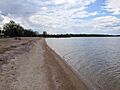
Rainbow Beach on Dauphin Lake
-
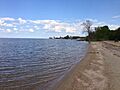
Rainbow Beach on Dauphin Lake


