
Day, Minnesota facts for kids
Quick facts for kids
Day
|
|
|---|---|

Day, Minnesota
Location in Minnesota

Day, Minnesota
Location in the United States
|
|
| Country | United States |
| State | Minnesota |
| County | Isanti |
| Township | Maple Ridge Township |
| Elevation | 1,033 ft (315 m) |
| Time zone | UTC-6 (Central (CST)) |
| • Summer (DST) | UTC-5 (CDT) |
| ZIP code |
55006
|
| Area code(s) | 320 |
| GNIS feature ID | 642660 |
Day is a small place in Minnesota, United States. It's called an "unincorporated community." This means it's a group of homes and businesses that isn't officially a town or city with its own local government. Day is located within Maple Ridge Township in Isanti County.
You can find Day by following Isanti County Roads 4 and 22. These are the main roads that go through the community. Other places nearby include Dalbo, Coin, and Braham. You can also find Lewis Lake and the Cranberry Wildlife Management Area close by. State Highway 47 is also in the area.
Getting Around Day
Day has a few important roads that help people travel in and out of the community.
Main Roads
- Isanti County Road 4
- Isanti County Road 22
Images for kids
-
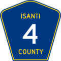
A sign for Isanti County Road 4.
-
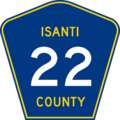
A sign for Isanti County Road 22.


All content from Kiddle encyclopedia articles (including the article images and facts) can be freely used under Attribution-ShareAlike license, unless stated otherwise. Cite this article:
Day, Minnesota Facts for Kids. Kiddle Encyclopedia.