Isanti County, Minnesota facts for kids
Quick facts for kids
Isanti County
|
||
|---|---|---|

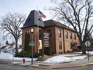
Old Isanti County Courthouse
|
||
|
||

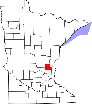
Location within the U.S. state of Minnesota
|
||
 Minnesota's location within the U.S. |
||
| Country | ||
| State | ||
| Founded | February 13, 1857 | |
| Named for | Izaty Indians | |
| Seat | Cambridge | |
| Largest city | Cambridge | |
| Area | ||
| • Total | 452 sq mi (1,170 km2) | |
| • Land | 436 sq mi (1,130 km2) | |
| • Water | 16 sq mi (40 km2) 3.5%% | |
| Population
(2020)
|
||
| • Total | 41,135 | |
| • Estimate
(2023)
|
43,182 |
|
| • Density | 88.8/sq mi (34.3/km2) | |
| Time zone | UTC−6 (Central) | |
| • Summer (DST) | UTC−5 (CDT) | |
| Congressional district | 8th | |
Isanti County (eye-SAN-tee) is a county located in the east-central part of Minnesota, a state in the United States. In 2020, about 41,135 people lived here. The main town, or county seat, is Cambridge.
Isanti County is part of the larger Minneapolis-St. Paul-Bloomington area, which is a major group of cities.
Contents
History of Isanti County
Isanti County was officially created on February 13, 1857. Its name comes from the Izaty Indians, an old name for the Santee Indians. The Santee are a group of Dakota Native Americans.
The word Isanti comes from the Dakota word for "knife." This name refers to the Santee tribe, who were known for their skills.
Exploring Isanti County's Geography
The Rum River flows south through the middle of Isanti County. The land here is quite hilly, with many small valleys and ditches. You'll also find lots of lakes and ponds scattered around.
The land generally slopes downwards towards the south and east. The highest point in the county is near its northwest corner, reaching about 1,020 feet (311 meters) above sea level.
Isanti County covers a total area of 452 square miles (1,171 square kilometers). Most of this, about 436 square miles (1,129 square kilometers), is land. The remaining 16 square miles (41 square kilometers), or 3.5%, is covered by water.
Major Roads in Isanti County
Several important roads help people travel through Isanti County:
Neighboring Counties
Isanti County shares its borders with several other counties:
- Kanabec County - to the north
- Pine County - to the northeast
- Chisago County - to the east
- Anoka County - to the south
- Sherburne County - to the southwest
- Mille Lacs County - to the northwest
Protected Natural Areas
Isanti County is home to several protected natural areas, which help preserve local wildlife and nature:
- Cranberry Wildlife Management Area
- Crooked Road State Wildlife Management Area
- Marget Lake State Wildlife Management Area
- Marvin W. Schubring Memorial Wildlife Management Area
- Maywood County Park
- Spectacle Lake Wildlife Management Area
- Springvale County Park
- Twin Lake Scientific and Natural Area
Population and People of Isanti County
| Historical population | |||
|---|---|---|---|
| Census | Pop. | %± | |
| 1860 | 284 | — | |
| 1870 | 2,035 | 616.5% | |
| 1880 | 5,063 | 148.8% | |
| 1890 | 7,607 | 50.2% | |
| 1900 | 11,675 | 53.5% | |
| 1910 | 12,615 | 8.1% | |
| 1920 | 13,278 | 5.3% | |
| 1930 | 12,081 | −9.0% | |
| 1940 | 12,950 | 7.2% | |
| 1950 | 12,123 | −6.4% | |
| 1960 | 13,530 | 11.6% | |
| 1970 | 16,560 | 22.4% | |
| 1980 | 23,600 | 42.5% | |
| 1990 | 25,921 | 9.8% | |
| 2000 | 31,287 | 20.7% | |
| 2010 | 37,816 | 20.9% | |
| 2020 | 41,135 | 8.8% | |
| 2023 (est.) | 43,182 | 14.2% | |
| U.S. Decennial Census 1790-1960 1900-1990 1990-2000 2010-2020 |
|||
The population of Isanti County has grown a lot over the years. In 1860, only 284 people lived there. By 2020, the population had reached 41,135. Experts estimate that in 2023, the population grew even more to about 43,182 people.
2020 Census Information
The 2020 census gives us a closer look at the people living in Isanti County.
| Race / Ethnicity | Pop 2010 | Pop 2020 | % 2010 | % 2020 |
|---|---|---|---|---|
| White alone (NH) | 35,958 | 37,559 | 95.09% | 91.31% |
| Black or African American alone (NH) | 228 | 314 | 0.60% | 0.83% |
| Native American or Alaska Native alone (NH) | 163 | 201 | 0.43% | 0.53% |
| Asian alone (NH) | 302 | 488 | 0.80% | 1.29% |
| Pacific Islander alone (NH) | 12 | 13 | 0.03% | 0.03% |
| Some Other Race alone (NH) | 20 | 154 | 0.05% | 0.41% |
| Mixed Race/Multi-Racial (NH) | 517 | 1,510 | 1.37% | 3.99% |
| Hispanic or Latino (any race) | 582 | 5,308 | 1.54% | 2.37% |
| Total | 37,816 | 41,135 | 100.00% | 100.00% |
Note: The U.S. Census counts Hispanic/Latino as an ethnic group. This means people who are Hispanic/Latino can be of any race.
Towns and Areas in Isanti County
Isanti County has several cities and other communities where people live.
Cities
- Braham (partially in Kanabec County)
- Cambridge (the county seat)
- Isanti
- St. Francis (mostly in Anoka County)
Census-Designated Place
Unincorporated Communities
These are smaller communities that are not officially organized as cities or towns:
Townships
Townships are smaller local government areas within the county:
- Athens Township
- Bradford Township
- Cambridge Township
- Dalbo Township
- Isanti Township
- Maple Ridge Township
- North Branch Township
- Oxford Township
- Spencer Brook Township
- Springvale Township
- Stanchfield Township
- Stanford Township
- Wyanett Township
See also
 In Spanish: Condado de Isanti para niños
 | DeHart Hubbard |
 | Wilma Rudolph |
 | Jesse Owens |
 | Jackie Joyner-Kersee |
 | Major Taylor |


