Rum River facts for kids
Quick facts for kids Rum River |
|
|---|---|
 |
|
| Native name | Watpa waḳaŋ (Dakota), Misi-zaaga'igani-ziibi (Ojibwe) |
| Country | United States |
| State | Minnesota |
| Physical characteristics | |
| Main source | Mille Lacs Lake Mille Lacs Indian Reservation 46°09′38″N 93°45′22″W / 46.160499°N 93.756020°W |
| River mouth | Mississippi River Anoka, Anoka County, MN 45°11′24″N 93°23′25″W / 45.189985°N 93.390311°W |
| Length | 151 mi (243 km) |

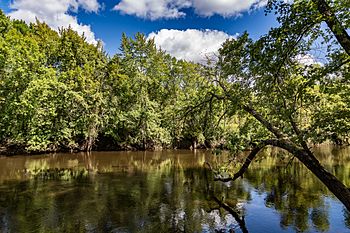
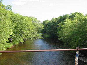
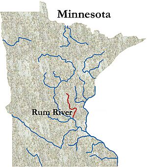
The Rum River is a calm river in Minnesota. It flows slowly, connecting Mille Lacs Lake to the mighty Mississippi River. The river is about 151 miles (243 km) long.
It passes through several towns. These include Onamia, Milaca, Princeton, Cambridge, Isanti, and St. Francis. The Rum River finally joins the Mississippi River in Anoka. This city is about 20 miles northwest of Minneapolis.
The Rum River is special because it is one of only six rivers in Minnesota protected as a Wild and Scenic river. This means it has natural, cultural, and recreational value that is preserved.
River History
The first European to see the Rum River was an explorer named Louis Hennepin. This happened in the spring of 1680. He was traveling with a group of Dakota people at the time.
Hennepin wrote about the river in his journals. He called it the St. Francis River. However, that name did not stay with the river. There is another river nearby, about 12 miles west, that is now called the St. Francis River.
River's Path and Boundaries
The Rum River makes a sharp turn south near Cambridge, Minnesota. During spring floods, the river's water can be very strong. It pushes through a wet area west of Cambridge because of this sharp bend.
In 1825, an important agreement was made. It was called the First Treaty of Prairie du Chien. A natural channel near Isanti, Minnesota, known as "Choking Creek," became a boundary. This boundary separated the lands of the Dakota people from the lands of the Ojibwe people.
In Princeton, Minnesota, the Rum River splits into two parts. These are called the Main Branch and the West Branch. When Mille Lacs County, Minnesota was first created, the West Branch of the Rum River was used as the border for the county. Today, the western border of Mille Lacs County follows a different survey line.
River Name History
The original name for the river comes from the Dakota people. They called it Watpa waḳaŋ. This means "Spirit River" or "Mystic River." This name came from Mille Lacs Lake, which they called Mde waḳaŋ, or "Spirit Lake."
Over time, the river's name changed as different groups explored the area. In 1702, a map by d'Isle called it Riviere des Mendeoüacanton. This meant "River of the Mdewakanton" (a Dakota group).
Later maps also used different names. A map from around 1730 called it Rivière de S. François ou des Nadouessioux. This means "St. Francis or Sioux River." In 1733, Henry Popple's map showed it as R. Nendivaocanton.
English-speaking fur traders started using the name "Rum River." This was noted by explorers like Carver in 1766 and Pike in 1805. It is believed that "Rum River" came from a misunderstanding or mistranslation of the Dakota name Watpa waḳaŋ.
The 1778 Mitchell Map called it Fiume del Lago, meaning "River of the Lake." In 1820, Henry Schoolcraft recorded the river's Ojibwe name, Missisawgaiegon. By 1832, maps showed both Missisagaigon and "Rum River."
Today, the Ojibwe people have two names for the river. One is Misi-zaaga'igani-ziibi, which means "Grand Lake River," referring to its source. The other is Ishkodewaaboo-ziibi, meaning "Fire-water River," which reflects the English name. The Dakota name also has a slight variation today, Wakpa waḳaŋ, alongside the historical Watpa waḳaŋ.
 | Selma Burke |
 | Pauline Powell Burns |
 | Frederick J. Brown |
 | Robert Blackburn |


