
Pine County, Minnesota facts for kids
Quick facts for kids
Pine County
|
|
|---|---|

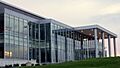
Pine County Courthouse, Pine City
|
|

Location within the U.S. state of Minnesota
|
|
 Minnesota's location within the U.S. |
|
| Country | |
| State | |
| Founded | March 1, 1856 (created) 1872 (organized) |
| Named for | The abundant pine trees in the area |
| Seat | Pine City |
| Largest city | Pine City |
| Area | |
| • Total | 1,435 sq mi (3,720 km2) |
| • Land | 1,411 sq mi (3,650 km2) |
| • Water | 23 sq mi (60 km2) 1.6%% |
| Population
(2020)
|
|
| • Total | 28,876 |
| • Estimate
(2023)
|
30,197 |
| • Density | 20.123/sq mi (7.7694/km2) |
| Time zone | UTC−6 (Central) |
| • Summer (DST) | UTC−5 (CDT) |
| Congressional district | 8th |
Pine County is a special area in the U.S. state of Minnesota. It's called a county. In 2020, about 28,876 people lived here. The main town, or county seat, is Pine City.
Pine County was first created in 1856. It was officially set up in 1872. Today, more and more people are choosing to live in Pine County. It is one of the fastest-growing counties in Minnesota! A part of the Mille Lacs Indian Reservation is also located in Pine County.
Contents
History of Pine County
Pine County was officially formed on March 1, 1856. It was made from parts of Chisago and Ramsey counties. The very first county seat was a place called Chengwatana. The county got its name because there were so many pine trees growing in the area.
How Pine County's Borders Changed
In 1857, some new counties were created from Pine County's original land. These included all of Buchanan County. Also, the southern parts of Aitkin and Carlton counties were formed. A year later, Kanabec County was also organized.
Later, in 1861, Buchanan County was closed down. Its land was added back into Pine County. Then, in 1872, Pine County was reorganized again. This time, Pine City became the new county seat. The county was smaller than it was originally.
Geography and Nature
Pine County is located on the eastern side of Minnesota. Its southeastern border touches Wisconsin. The St. Croix River forms this border. It flows south along the edge of the county.
Rivers and Lakes
The Kettle River flows southeast through the middle of Pine County. It empties into the St. Croix River on the county's eastern side. The Snake River also flows east through the lower part of the county. It also joins the St. Croix River.
The land in Pine County has gentle, rolling hills. These hills have been shaped by rivers and streams. Some parts are covered in forests, while others are used for farming. The land generally slopes down towards the south and east. The highest point in the county is about 1,319 feet (402 meters) above sea level. This spot is near the northeastern corner.
Pine County covers about 1,435 square miles (3,717 square kilometers). Most of this is land, about 1,411 square miles (3,654 square kilometers). About 23 square miles (60 square kilometers) is water. One of the most well-known lakes in Pine County is Devil's Lake. You can find it on the southeastern edge of Pine City.
Main Roads in Pine County
 Interstate 35
 Minnesota State Highway 18
 Minnesota State Highway 23
 Minnesota State Highway 48
 Minnesota State Highway 70
 Minnesota State Highway 107
 Minnesota State Highway 123
Neighboring Counties
Pine County shares its borders with several other counties.
- Carlton County to the north
- Douglas County, Wisconsin to the northeast
- Burnett County, Wisconsin to the east
- Chisago County to the south
- Isanti County to the southwest
- Kanabec County to the west
- Aitkin County to the northwest
Parks and Protected Areas
Pine County is home to many beautiful natural areas. These places are protected for everyone to enjoy.
- Banning State Park
- Chengwatana State Forest
- DAR Memorial State Forest
- General C. C. Andrews State Forest
- Kettle River Scientific and Natural Area
- Nemadji State Forest (part)
- Pine County State Game Refuge
- Saint Croix National Scenic Riverway (part)
- St. Croix State Park
- Wild River State Park (part)
People of Pine County
The population of Pine County has changed a lot over the years. Here's a look at how many people have lived there during different census counts:
| Historical population | |||
|---|---|---|---|
| Census | Pop. | %± | |
| 1860 | 92 | — | |
| 1870 | 648 | 604.3% | |
| 1880 | 1,365 | 110.6% | |
| 1890 | 4,052 | 196.8% | |
| 1900 | 11,546 | 184.9% | |
| 1910 | 15,878 | 37.5% | |
| 1920 | 21,117 | 33.0% | |
| 1930 | 20,264 | −4.0% | |
| 1940 | 21,478 | 6.0% | |
| 1950 | 18,223 | −15.2% | |
| 1960 | 17,004 | −6.7% | |
| 1970 | 16,821 | −1.1% | |
| 1980 | 19,871 | 18.1% | |
| 1990 | 21,264 | 7.0% | |
| 2000 | 26,530 | 24.8% | |
| 2010 | 29,750 | 12.1% | |
| 2020 | 28,876 | −2.9% | |
| 2023 (est.) | 30,197 | 1.5% | |
| U.S. Decennial Census 1790-1960 1900-1990 1990-2000 2010-2020 |
|||
Population in 2020
The 2020 census gives us a good picture of the people living in Pine County.
| Race / Ethnicity | Pop 2010 | Pop 2020 | % 2010 | % 2020 |
|---|---|---|---|---|
| White alone (NH) | 26,924 | 25,119 | 90.50% | 86.99% |
| Black or African American alone (NH) | 576 | 470 | 1.94% | 1.63% |
| Native American or Alaska Native alone (NH) | 890 | 966 | 2.99% | 3.35% |
| Asian alone (NH) | 129 | 264 | 0.43% | 0.91% |
| Pacific Islander alone (NH) | 8 | 1 | 0.03% | 0.00% |
| Some Other Race alone (NH) | 4 | 98 | 0.01% | 0.34% |
| Mixed Race/Multi-Racial (NH) | 496 | 1,245 | 1.67% | 4.31% |
| Hispanic or Latino (any race) | 723 | 713 | 2.43% | 2.47% |
| Total | 29,750 | 28,876 | 100.00% | 100.00% |
Note: The US Census counts people based on their ethnic background. This table separates people who are Hispanic/Latino from other racial groups. People who are Hispanic/Latino can be of any race.
Towns and Communities
Pine County has many different towns and communities. Some are cities, some are smaller unincorporated communities, and some are even "ghost towns" where people used to live.
Cities in Pine County
Smaller Communities (Unincorporated)
These places are not officially cities or towns.
Ghost Towns of Pine County
These are places where people once lived, but now they are mostly empty or abandoned.
- Belden
- Banning
- Big Spring
- Blomskog
- Chengwatana
- Cornell
- Clint
- Crooked River
- Danewood
- Eaglehead
- Harlis
- Midway
- Milburn
- Mission Creek
- Outflow
- Sand River
- Tozer Camp
- Turpville
- Tuxedo
- Villstad
- Wareham
Townships in Pine County
Townships are smaller local government areas.
- Arlone Township
- Arna Township
- Barry Township
- Birch Creek Township
- Bremen Township
- Brook Park Township
- Bruno Township
- Chengwatana Township
- Clover Township
- Crosby Township
- Danforth Township
- Dell Grove Township
- Finlayson Township
- Fleming Township
- Hinckley Township
- Kerrick Township
- Kettle River Township
- Mission Creek Township
- Munch Township
- New Dosey Township
- Nickerson Township
- Norman Township
- Ogema Township
- Park Township
- Partridge Township
- Pine City Township
- Pine Lake Township
- Pokegama Township
- Royalton Township
- Sandstone Township
- Sturgeon Lake Township
- Wilma Township
- Windemere Township
Images for kids
-
Pine County Courthouse, Pine City
See also
 In Spanish: Condado de Pine para niños
