Kettle River (St. Croix River tributary) facts for kids
Quick facts for kids Kettle River |
|
|---|---|
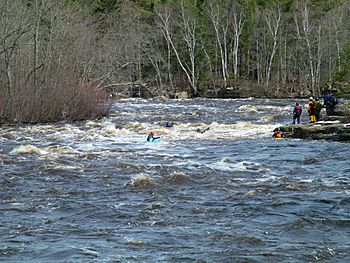
Kayakers on the Kettle River in Banning State Park
|
|
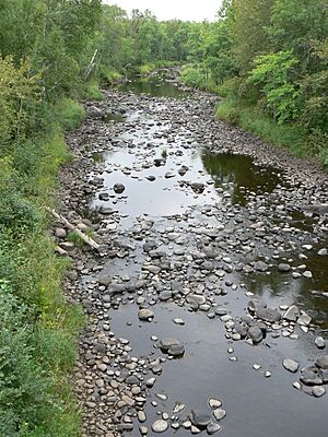
The Kettle River
|
|
|
Mouth of the Kettle River
|
|
| Country | United States |
| State | Minnesota |
| County | Carlton County, Pine County |
| Physical characteristics | |
| Main source | 46°41′14″N 92°47′17″W / 46.6871686°N 92.7879778°W |
| River mouth | 45°51′28″N 92°44′11″W / 45.8577304°N 92.7363141°W |
| Length | 83.6 mi-long (134.5 km) |
| Basin features | |
| River system | St. Croix River |
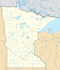
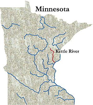
The Kettle River is a river in eastern Minnesota, United States. It is about 83.6 miles (134.5 kilometers) long. The Kettle River flows into the St. Croix River. The St. Croix River then joins the mighty Mississippi River. This means the Kettle River is part of the huge watershed of the Mississippi River.
The river gets its English name from the many large, rounded holes found in the sandstone rocks. These holes are called "kettles." The swirling water of the river carves them out over time. The Dakota people called the river Céġa watpa. The Anishinaabe people called it Akiko-ziibi. Both of these names also mean "Kettle River."
Contents
Exploring the Kettle River's Features
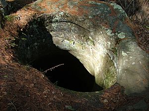
The water in the Kettle River often has an amber or tea-like color. This tint comes from natural plant materials called tannins. Tannins are like leaf colorings from wetlands that drain into the river. This natural coloring is not caused by pollution.
The river's flow can change very quickly. It depends on how much rain falls in the area. The Kettle River's drainage basin covers about 1,060 square miles (2,745 square kilometers). It's common for the river to become a small trickle during dry summer days. But after a few days of rain, it can turn into a powerful whitewater torrent.
Normal water flows usually range from 200 to over 6,000 cubic feet per second. This means a lot of water can move through the river very fast!
Deep Pools and Ancient Fish
Some parts of the Kettle River are very deep. Some pools can be over 100 feet (30 meters) deep! These deep areas and the good water quality help support a population of ancient fish called sturgeon.
Sturgeon are very large and old fish. Until May 2018, the biggest fish ever caught in Minnesota was a sturgeon. It was 70 inches (1.8 meters) long and weighed 94 pounds 4 ounces (42.8 kilograms). This huge fish was caught in the Kettle River in 1994. Later, an even bigger sturgeon was caught in the Rainy River.
Sections of the Kettle River
The Kettle River changes its character as it flows. Different sections offer different experiences.
Upper River Section
The upper part of the river, which is above Banning State Park, moves fairly quickly. It has many small rapids called "riffles" and a few Class I rapids. This section is good for boating when the water levels are moderate to high. This usually means flows around 900 cubic feet per second.
Banning State Park Rapids
As the river reaches Banning State Park, it changes a lot. The river drops through a series of rapids. These rapids can range from Class I (easy) to Class IV (difficult).
These rapids can be fun for canoeing when water levels are low to moderate. This is usually between 600 to 900 cubic feet per second. However, during very high water (around 4,500 cubic feet per second), these rapids can become dangerous. Even experienced whitewater kayakers and rafters need to be careful. The river has steep rocky sides, undercut banks, and kettles. These features can make rescues very difficult if someone gets into trouble.
After Big Spring Falls
Shortly after leaving Banning State Park, the river becomes much calmer. Then you reach Big Spring Falls. This waterfall was rebuilt in 1995. An old dam, built in 1908, was removed to help restore the river. Removing the dam allowed sturgeon to travel further up the river. There is a small picnic area near the falls. You can also find a path to carry boats down to the water.
From Big Spring Falls to where it meets the St. Croix River, the Kettle River continues to drop. It has frequent riffles and occasional Class I rapids. The rapids become more common as the river gets closer to the St. Croix. This last section is great for canoeing. It has manageable rapids, good fishing, and lots of wildlife. You might even see bears! It's also a quiet area with fewer people.
White Water Fun on the Kettle River
The Kettle River is a popular spot for white water recreation. It has Class III-IV white water rapids. Many people enjoy paddling here in kayaks, canoes, and rafts.
Kettle River Tributaries
The Kettle River flows into the St. Croix River about 10 miles (16 kilometers) east-northeast of Pine City.
Near its beginning, the Kettle River collects water from the West Branch Kettle River. This branch flows southeast from its source near Wright. Other rivers that flow into the Kettle River include:
- The Dead Moose River
- The Split Rock River (both in Carlton County)
- The Moose Horn River
- The Willow River
- The Pine River
- The Grindstone River (these last four are in Pine County)
Wolf Creek, located in Banning State Park, has a 12-foot (3.7-meter) waterfall. It drops over this waterfall just before joining the Kettle River.
History of the Kettle River
Artists Clara Mairs and Clement Haupers often visited the Kettle River. They created many paintings of the people and the beautiful landscape around the river.
 | John T. Biggers |
 | Thomas Blackshear |
 | Mark Bradford |
 | Beverly Buchanan |


