
Burnett County, Wisconsin facts for kids
Quick facts for kids
Burnett County
|
|
|---|---|

Burnett County Government Center
|
|

Location within the U.S. state of Wisconsin
|
|
 Wisconsin's location within the U.S. |
|
| Country | |
| State | |
| Founded | 1865 |
| Named for | Thomas P. Burnett |
| Seat | Siren |
| Largest village | Grantsburg |
| Area | |
| • Total | 880 sq mi (2,300 km2) |
| • Land | 822 sq mi (2,130 km2) |
| • Water | 58 sq mi (150 km2) 6.6% |
| Population
(2020)
|
|
| • Total | 16,526 |
| • Estimate
(2023)
|
17,092 |
| • Density | 18.78/sq mi (7.25/km2) |
| Time zone | UTC−6 (Central) |
| • Summer (DST) | UTC−5 (CDT) |
| Congressional district | 7th |
Burnett County is a cool place in Wisconsin, a state in the United States. About 16,526 people lived here in 2020. The main town, or county seat, is Siren. This is where most of the county's government offices are, at the Burnett County Government Center.
Burnett County was officially started in 1865. The St. Croix Chippewa Indians of Wisconsin have special lands here. They are also the biggest employer in the county, meaning they provide the most jobs!
Contents
Exploring Burnett County's Geography
Burnett County covers a total area of about 880 square miles. Most of this is land, about 822 square miles. The rest, about 58 square miles, is water. That means about 6.6% of the county is covered by water. You can find Saginaw Lake here, which is south of the Namekagon River.
Neighboring Counties Around Burnett
Burnett County shares its borders with several other counties.
- Douglas County is to the northeast.
- Washburn County is to the east.
- Barron County is to the southeast.
- Polk County is to the south.
- Chisago County, Minnesota is to the southwest.
- Pine County, Minnesota is to the west.
Main Roads in Burnett County
These are some of the important highways that help people travel through Burnett County:
 Highway 35 (Wisconsin)
 Highway 48 (Wisconsin)
 Highway 70 (Wisconsin)
 Highway 77 (Wisconsin)
 Highway 87 (Wisconsin)
Airports Serving the Area
Burnett County has two airports. They help people fly in and out of the county.
- Burnett County Airport (KRZN)
- Grantsburg Municipal Airport (KGTG)
Protected Natural Areas
Part of the Saint Croix National Scenic Riverway is located in Burnett County. This is a special area protected for its natural beauty.
People and Population in Burnett County
| Historical population | |||
|---|---|---|---|
| Census | Pop. | %± | |
| 1860 | 12 | — | |
| 1870 | 706 | 5,783.3% | |
| 1880 | 3,140 | 344.8% | |
| 1890 | 4,393 | 39.9% | |
| 1900 | 7,478 | 70.2% | |
| 1910 | 9,026 | 20.7% | |
| 1920 | 10,735 | 18.9% | |
| 1930 | 10,233 | −4.7% | |
| 1940 | 11,382 | 11.2% | |
| 1950 | 10,236 | −10.1% | |
| 1960 | 9,214 | −10.0% | |
| 1970 | 9,276 | 0.7% | |
| 1980 | 12,340 | 33.0% | |
| 1990 | 13,084 | 6.0% | |
| 2000 | 15,674 | 19.8% | |
| 2010 | 15,457 | −1.4% | |
| 2020 | 16,526 | 6.9% | |
| U.S. Decennial Census 1790–1960 1900–1990 1990–2000 2010 2020 |
|||
In 2020, about 16,526 people lived in Burnett County. Most people living here are White (89.3%). About 4.4% are Native American. Other groups include Black or African American, Asian, and Pacific Islander people. About 1.5% of the population is Hispanic or Latino.
Towns and Villages in Burnett County
Burnett County is special because it does not have any "cities." It is one of only three counties in Wisconsin like this. It has villages and towns instead.
Villages You Can Visit
- Grantsburg
- Siren (This is the county seat!)
- Webster
Towns in the County
- Anderson
- Blaine
- Daniels
- Dewey
- Grantsburg
- Jackson
- La Follette
- Lincoln
- Meenon
- Oakland
- Roosevelt
- Rusk
- Sand Lake
- Scott
- Siren
- Swiss
- Trade Lake
- Union
- Webb Lake
- West Marshland
- Wood River
Special Community: Census-Designated Place
Other Small Communities
Images for kids
-
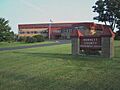
The Burnett County Government Center, where county services are located.
See also
 In Spanish: Condado de Burnett para niños
