Deadwood River (Idaho) facts for kids
Quick facts for kids Deadwood River |
|
|---|---|

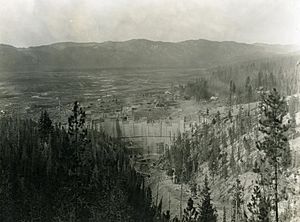
Construction of the Deadwood Dam in 1930
|
|
|
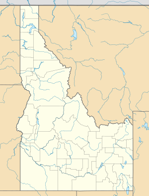
Location of the mouth of Deadwood River in Idaho
|
|
| Country | United States |
| State | Idaho |
| Region | Valley and Boise counties |
| Physical characteristics | |
| Main source | Deadwood Summit 6,965 ft (2,123 m) 44°32′39″N 115°33′48″W / 44.54417°N 115.56333°W |
| River mouth | South Fork Payette River 3,700 ft (1,100 m) 44°04′45″N 115°39′30″W / 44.07917°N 115.65833°W |
| Length | 43.5 mi (70.0 km) |
| Basin features | |
| Basin size | 109 sq mi (280 km2) |
The Deadwood River is a cool river in Idaho, United States. It flows for about 43.5 miles (70 km). This river is an important part of the South Fork Payette River system. It winds through the beautiful Boise National Forest. You can find it in Valley and Boise counties.
Contents
Journey of the Deadwood River
The Deadwood River starts high up in the Salmon River Mountains. Its source is below a place called Deadwood Summit. This is on a forest road known as 579.
Where the River Ends
After its long journey, the Deadwood River joins the South Fork Payette River. This meeting point is about 3 miles (5 km) west of a town called Lowman.
Deadwood Dam and Reservoir
The Deadwood River is home to a very important structure. This is the Deadwood Dam. The dam was finished in 1931.
Creating Deadwood Reservoir
When the Deadwood Dam was built, it held back the river's water. This created a large body of water known as the Deadwood Reservoir. Reservoirs like this are often used for things like storing water or generating electricity.
Nature Around the River
The Deadwood River flows through the Boise National Forest. This forest is a home for many different kinds of plants and animals. The river and its surrounding areas are important for wildlife.
 | James Van Der Zee |
 | Alma Thomas |
 | Ellis Wilson |
 | Margaret Taylor-Burroughs |


