Valley County, Idaho facts for kids
Quick facts for kids
Valley County
|
||
|---|---|---|

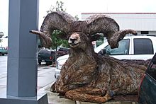
Bighorn Ram, Recycled Barbed Wire Sculpture in Cascade, Idaho
|
||
|
||

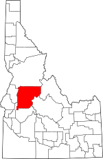
Location within the U.S. state of Idaho
|
||
 Idaho's location within the U.S. |
||
| Country | ||
| State | ||
| Founded | February 26, 1917 | |
| Named for | The Long Valley of the North Fork of the Payette River | |
| Seat | Cascade | |
| Largest city | McCall | |
| Area | ||
| • Total | 3,733 sq mi (9,670 km2) | |
| • Land | 3,665 sq mi (9,490 km2) | |
| • Water | 68 sq mi (180 km2) 1.8% | |
| Population
(2020)
|
||
| • Total | 11,746 |
|
| • Density | 3.1/sq mi (1.2/km2) | |
| Time zone | UTC−7 (Mountain) | |
| • Summer (DST) | UTC−6 (MDT) | |
| Congressional district | 1st | |
Valley County is a beautiful rural area located in the state of Idaho. In 2020, about 11,746 people lived there. Its main town is Cascade, and the biggest city is McCall.
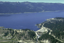
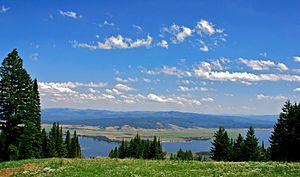
Valley County was created in 1917. It got its name from the Long Valley of the North Fork of the Payette River. This valley stretches for over 30 miles from Payette Lake near McCall down to Cascade. Long ago, this valley was a summer home for livestock from the Boise Valley. After the Cascade Dam was built in 1948, a large part of the northern valley became the Cascade Reservoir.
Valley County is also home to the Idaho ground squirrel.
Contents
Exploring Valley County's Past
Early Settlers and Gold Rush
In the 1860s, a man named Packer John Welch set up a camp on Gold Fork Creek. He was bringing supplies to miners in Idaho City. He also built a small cabin and a station near where the town of Cascade is today.
During the 1870s, people started looking for gold in the area. Mines like the Clara Foltz mines opened. Other places like Boulder and Gold Fork Creeks also had gold diggings.
Native American History and New Communities
By the late 1870s, the last members of the Sheepeater Tribe moved from Long Valley and Round Valley to a reservation. As the gold became harder to find, some miners decided to stay and farm the land. James Horner built a cabin on Clear Creek in 1881. Other miners settled near the Payette River.
In 1888, the first post offices in Valley County opened in places like VanWyck and Lardo. In 1889, Louis McCall and other settlers made their homes near Payette Lake. Their homes eventually grew into the town of McCall. Lardo became a stop for freight, helping the growing mining activity at Warren Meadows.
Growth and Challenges in the 1890s
The 1890 census showed that 538 people lived in the VanWyck area and 110 in the Alpha area. Maps from the 1890s show four schools and sawmills. There was also a small reservoir near VanWyck.
The 1890s were a tough time for the new settlers. Ranchers from south of Long Valley would bring their large herds of cattle to graze there every year. The homesteaders didn't like this and sometimes killed the outsiders' cattle.
Gold was found in the Thunder Mountain area in 1893. By 1902, W.H. Dewey started mining on a large scale. Up to 3,000 miners rushed into the region.
Modern Economy and War Efforts
From the 1910s onward, logging became very important, along with farming and ranching. These activities became the main ways people made a living in Long Valley. Towns far from the railroad, like Alpha, Crawford, and Roseberry, slowly disappeared. But towns near the railroad, such as Cascade, Donnelly, and McCall, grew and became the main population centers of Valley County.
The Stibnite Mining District, located near Yellow Pine, was very important during World War II. It helped the country's war efforts by providing valuable minerals.
Valley County's Landscape
According to the U.S. Census Bureau, Valley County covers about 3,733 square miles. Most of this area, about 3,665 square miles, is land. The remaining 68 square miles (1.8%) is water. It is the fifth-largest county in Idaho by size.
Neighboring Counties
Valley County shares its borders with several other counties:
- Idaho County - to the north
- Adams County - to the west
- Gem County - to the southwest
- Boise County - to the south
- Custer County - to the east
- Lemhi County - to the east
Protected Natural Areas
Part of Valley County is covered by beautiful national forests:
- Boise National Forest
- Payette National Forest
- Salmon-Challis National Forest
Getting Around Valley County

Main Roads
 SH 55 - Payette River Scenic Byway
The main highway in Valley County is State Highway 55. It's known as the Payette River Scenic Byway and is a special national scenic byway. This highway goes north from Eagle to Horseshoe Bend. It then follows the exciting whitewater of the Payette River up to Cascade and McCall. The road turns west at Payette Lake in McCall and ends at New Meadows. There it connects with US-95.
Airports
Valley County has several airports that are open to the public. These airports are owned by the state, the U.S. Forest Service, and local towns.
- Bernard USFS Airport (U54)
- Big Creek Airport (U60)
- Bruce Meadows Airport (U63)
- Cabin Creek USFS Airport (I08)
- Cascade Airport (U70)
- Donald D. Coski Memorial Airport (U84)
- Indian Creek USFS Airport (S81)
- Johnson Creek Airport (3U2)
- Krassel USFS Airport (24K)
- Landmark USFS Airport (0U0)
- Mahoney Creek USFS Airport (0U3)
- McCall Municipal Airport (MYL)
- Soldier Bar USFS Airport (85U)
- Thomas Creek Airport (2U8)
colend}}
People of Valley County
| Historical population | |||
|---|---|---|---|
| Census | Pop. | %± | |
| 1920 | 2,524 | — | |
| 1930 | 3,488 | 38.2% | |
| 1940 | 4,035 | 15.7% | |
| 1950 | 4,270 | 5.8% | |
| 1960 | 3,663 | −14.2% | |
| 1970 | 3,609 | −1.5% | |
| 1980 | 5,604 | 55.3% | |
| 1990 | 6,109 | 9.0% | |
| 2000 | 7,651 | 25.2% | |
| 2010 | 9,862 | 28.9% | |
| 2020 | 11,746 | 19.1% | |
| 2023 (est.) | 12,644 | 28.2% | |
| U.S. Decennial Census 1790–1960, 1900–1990, 1990–2000, 2010–2020 2020 |
|||
In 2010, there were 9,862 people living in Valley County. Most people (95.8%) were white. About 3.9% of the population was of Hispanic or Latino origin. Many people had German (33.9%), English (19.3%), or Irish (12.8%) backgrounds. The average age of people in the county was 46.9 years old.
Towns and Villages
Cities
Designated Places
These are areas that are like towns but are not officially incorporated as cities:
Other Small Communities
- Big Creek
- Lake Fork
- Roseberry
- Warm Lake
Ski Areas
Valley County is a great place for winter sports! It has several popular ski resorts:
- Brundage Mountain (opened in 1961)
- Little Ski Hill (opened in 1937)
- Tamarack Resort (opened in 2004)
Education
Children in Valley County attend schools in these districts:
- Cascade School District 422
- McCall-Donnelly Joint School District 421
For higher education, residents are near the College of Western Idaho.
See also
 In Spanish: Condado de Valley (Idaho) para niños
 | Aaron Henry |
 | T. R. M. Howard |
 | Jesse Jackson |


