Thunder Mountain (Idaho) facts for kids
Quick facts for kids Thunder Mountain |
|
|---|---|
| Highest point | |
| Elevation | 7,455 ft (2,272 m) |
| Prominence | 675 ft (206 m) |
| Parent peak | Cache Peak |
| Geography | |
| Location | Cassia County, Idaho, U.S. |
| Parent range | Albion Mountains |
| Topo map | USGS Elba |
| Climbing | |
| Easiest route | Simple scramble, class 2 |
Thunder Mountain is a cool peak located in the Albion Mountains of Idaho, USA. It stands tall at about 7,455 feet (2,272 m) above sea level. This mountain is found within the beautiful Sawtooth National Forest and is part of Cassia County. It's also pretty close to another peak called Cache Peak, only about 2.7 mi (4.3 km) to its southeast.
Contents
Discover Thunder Mountain
Thunder Mountain is a fascinating natural landmark in Idaho. It's a great example of the many amazing mountains you can find in the western United States. Mountains like Thunder Mountain are formed over millions of years by powerful forces deep within the Earth. They offer incredible views and are home to lots of different plants and animals.
Where is Thunder Mountain?
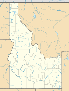
This impressive peak is located in the southern part of Idaho. Specifically, it's in Cassia County. The mountain is part of a larger group of mountains known as the Albion Mountains. These mountains are known for their rugged beauty and natural landscapes.
The Albion Mountains
The Albion Mountains are a mountain range in south-central Idaho. They are part of the Basin and Range Province, which stretches across much of the western United States. These mountains are made up of ancient rocks. They create a dramatic landscape with high peaks and deep valleys.
Sawtooth National Forest
Thunder Mountain is also inside the Sawtooth National Forest. This forest is a huge protected area in Idaho. It covers over 2 million acres! The Sawtooth National Forest is famous for its stunning scenery, including jagged peaks, clear lakes, and dense forests. It's a popular place for outdoor activities like hiking and camping.
How to Reach the Top
If you wanted to climb Thunder Mountain, the easiest way up is described as a "simple scramble." This means it's not a regular walk, but it's also not difficult rock climbing.
What is Scrambling?
Scrambling is a type of climbing that's somewhere between hiking and rock climbing. You might need to use your hands to help you balance or pull yourself up. It often involves moving over rocky or steep terrain. The difficulty rating for Thunder Mountain's easiest route is class 2. This means it's a very basic scramble, suitable for people with some outdoor experience.
Finding Your Way
To pinpoint Thunder Mountain on a map, you can use its coordinates: 42°10′18″N 113°36′49″W / 42.1715802°N 113.6136194°W. These numbers tell you the exact latitude and longitude of the peak. They are like a unique address for any spot on Earth. The USGS Elba map also shows Thunder Mountain. This map is a detailed guide for the area.
 | Laphonza Butler |
 | Daisy Bates |
 | Elizabeth Piper Ensley |


