
Gem County, Idaho facts for kids
Quick facts for kids
Gem County
|
||
|---|---|---|

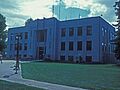
Gem County Courthouse
|
||
|
||

Location within the U.S. state of Idaho
|
||
 Idaho's location within the U.S. |
||
| Country | ||
| State | ||
| Founded | March 15, 1915 | |
| Named for | the state nickname, "Gem State". | |
| Seat | Emmett | |
| Largest city | Emmett | |
| Area | ||
| • Total | 566 sq mi (1,470 km2) | |
| • Land | 561 sq mi (1,450 km2) | |
| • Water | 4.8 sq mi (12 km2) 0.8% | |
| Population
(2020)
|
||
| • Total | 19,123 | |
| • Density | 33.786/sq mi (13.045/km2) | |
| Time zone | UTC−7 (Mountain) | |
| • Summer (DST) | UTC−6 (MDT) | |
| Congressional district | 1st | |

Gem County is a special area in the state of Idaho, USA. It's called a county. In 2020, about 19,123 people lived there. The main city and biggest town in Gem County is Emmett.
Gem County is part of a larger area called the Boise Metropolitan Statistical Area. This means it's connected to the bigger city of Boise.
A special animal, the Idaho ground squirrel, calls Gem County home.
Contents
History of Gem County
Gem County got its name from Idaho's nickname, "Gem State." It was officially created on March 15, 1915. Before that, its land was part of Canyon County and Boise County.
Long ago, around 1818, fur trappers visited the area. In 1824, a famous explorer named Alexander Ross explored Squaw Creek.
In 1862, people looking for gold, called prospectors and miners, traveled through the county. They were heading to the gold rush area near Idaho City. By the next year, people started using irrigation to water crops along the Payette River.
The area was once part of Idaho County under Washington Territory. Later, in 1863, the land south of the Payette River became part of Boise County.
Between 1862 and 1864, a group of horse thieves and fake gold sellers used a place called Picket's Corral as their base. But a group called the Payette Vigilance Committee stopped them. This made the area safer for everyone.
Around 1862, two men, Jonathan Smith and Nathaniel Martin, settled near Emmett. In 1866, they started a ferry service across the Payette River in Emmett. A post office opened there in 1867, first called Martinsville, then Emmettsville, and finally just Emmett in 1885.
Later, in the early 1920s, the Black Canyon Diversion Dam was built on the Payette River, east of Emmett.
Geography of Gem County
Gem County covers about 566 square miles (1,466 square kilometers). Most of this area, 561 square miles (1,453 square kilometers), is land. Only a small part, about 4.8 square miles (12 square kilometers), is water. It's one of the smaller counties in Idaho.
Neighboring Counties
Gem County shares borders with several other counties:
- Washington County to the northwest
- Adams County to the north
- Valley County to the northeast
- Boise County to the east
- Ada County to the south
- Canyon County to the southwest
- Payette County to the west
Protected Natural Areas
Part of the Boise National Forest is located within Gem County. This is a large area of protected land.
People of Gem County
| Historical population | |||
|---|---|---|---|
| Census | Pop. | %± | |
| 1920 | 6,427 | — | |
| 1930 | 7,419 | 15.4% | |
| 1940 | 9,544 | 28.6% | |
| 1950 | 8,730 | −8.5% | |
| 1960 | 9,127 | 4.5% | |
| 1970 | 9,387 | 2.8% | |
| 1980 | 11,972 | 27.5% | |
| 1990 | 11,844 | −1.1% | |
| 2000 | 15,181 | 28.2% | |
| 2010 | 16,719 | 10.1% | |
| 2020 | 19,123 | 14.4% | |
| 2023 (est.) | 21,071 | 26.0% | |
| U.S. Decennial Census 1790–1960, 1900–1990, 1990–2000, 2010, 2020 |
|||
What the 2010 Census Showed
In 2010, there were 16,719 people living in Gem County. Most people (93.4%) were white. About 8.0% of the population were of Hispanic or Latino background. Many residents had ancestors from Germany (23.2%), England (19.2%), or Ireland (12.3%).
The average age of people in the county was about 42.9 years old. The average income for a family was around $49,976 per year. About 14.7% of the people in the county lived below the poverty line.
What the 2020 Census Showed
| Race | Pop 2010 | Pop 2020 | % 2010 | % 2020 |
|---|---|---|---|---|
| White (NH) | 14,898 | 16,132 | 89.11% | 84.36% |
| Black or African American (NH) | 20 | 29 | 0.12% | 0.15% |
| Native American or Alaska Native (NH) | 77 | 124 | 0.46% | 0.65% |
| Asian (NH) | 78 | 99 | 0.47% | 0.52% |
| Pacific Islander (NH) | 10 | 20 | 0.06% | 0.1% |
| Some Other Race (NH) | 13 | 96 | 0.08% | 0.5% |
| Mixed/Multi-Racial (NH) | 287 | 901 | 1.72% | 4.71% |
| Hispanic or Latino | 1,336 | 1,722 | 7.99% | 9.0% |
| Total | 16,719 | 19,123 |
In 2020, the population of Gem County grew to 19,123 people. There were 6,683 households, which are groups of people living together.
Communities in Gem County
Cities
- Emmett is the only city in Gem County.
Designated Places
- Letha is a place recognized by the census, but it's not an official city.
Other Small Towns
Education in Gem County
There is one main school district for all students from kindergarten to 12th grade. It's called the Emmett Independent School District 221.
Even though residents are near the College of Western Idaho, they don't pay taxes to support it.
Healthcare in Gem County
The Southwest Idaho Health District helps provide healthcare services for the county.
Images for kids
-
Gem County Courthouse
See also
 In Spanish: Condado de Gem para niños
