Lowman, Idaho facts for kids
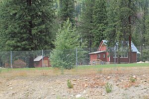
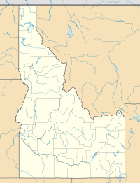
Lowman is a tiny community in Boise County, Idaho, in the United States. It's a small place where people live, located right next to the South Fork of the Payette River. This river is in the middle of Idaho, and Lowman sits about 3,800 feet (1,158 meters) above sea level. In 2010, only 42 people lived there!
Contents
History of Lowman
Lowman got its name from a man named Nathaniel Winfield Lowman. He came from Iowa and settled here in 1907. He was a "homesteader," which means he claimed land to live on and farm.
One cool thing about Lowman is that it has a one-room school. Imagine all the students, from different grades, learning together in just one classroom! There are only a couple hundred of these schools left in the whole United States.
In 1989, a huge wildfire swept through the area around Lowman. It burned over 45,000 acres (about 70 square miles or 182 square kilometers) of land. The fire also destroyed 26 buildings. Luckily, no one was hurt or killed in the fire.
Geography and Nature
Lowman is about 80 miles (129 kilometers) from Boise, Idaho's capital city. You can get there by driving on State Highway 21, which is also called the "Ponderosa Pine Scenic Byway." Lowman is where this highway meets another road, the "Banks-Lowman Highway." This road is now called Highway 2512A and is known as the "Wildlife Canyon Scenic Byway." It goes west, following the South Fork of the Payette River, which has exciting whitewater rapids!
The "Highway to Heaven" trail is a long path that starts in Boise and stretches for more than 150 miles (241 kilometers). It's special because it's one of the only mountain trails in the western U.S. that begins in a big city. The trail climbs up, passing the Lucky Peak Dam. You'll see sagebrush turn into pine forests as you head towards historic Idaho City. Then, it goes over high points like Mores Creek Summit and Beaver Creek Summit, with winding roads. Finally, it switches back down to Lowman. The route continues to climb with the South Fork of the Payette River, going over Banner Summit, until it reaches Stanley, near the amazing Sawtooth Mountains.
Lowman is in an area with lots of geothermal activity. This means there's heat coming from deep inside the Earth. Because of this, you can find natural hot springs right in the middle of the community and in the mountains nearby.
Climate
Lowman has a type of climate called a humid continental climate. This means it has big changes in temperature throughout the year. Summers are usually warm to hot, and sometimes humid. Winters are cold, and can even be very cold!
Population Information
| Historical population | |||
|---|---|---|---|
| Census | Pop. | %± | |
| 2000 | 38 | — | |
| 2010 | 42 | 10.5% | |
| U.S. Decennial Census | |||
The population of Lowman is quite small. In 2000, 38 people lived there. By 2010, the population had grown slightly to 42 people.
Transportation
 - SH-21 - This highway connects Lowman to Idaho City and Boise to the south, and to Stanley to the north.
Notable Residents
Some interesting people have lived in Lowman:
- Gordon Bess - He was a cartoonist, famous for creating the comic strip Redeye.
- Robin Fontes - She had a long career in the military and retired as a Major General before returning to Idaho.
See also
 In Spanish: Lowman para niños
 | Calvin Brent |
 | Walter T. Bailey |
 | Martha Cassell Thompson |
 | Alberta Jeannette Cassell |


