
Delaplaine, Arkansas facts for kids
Quick facts for kids
Delaplaine, Arkansas
|
|
|---|---|

AR 304 approaching its intersection with AR 34 and AR 90 in Delaplaine
|
|

Location of Delaplaine in Greene County, Arkansas.
|
|
| Country | United States |
| State | Arkansas |
| County | Greene |
| Area | |
| • Total | 1.11 sq mi (2.86 km2) |
| • Land | 1.11 sq mi (2.86 km2) |
| • Water | 0.00 sq mi (0.00 km2) |
| Elevation | 276 ft (84 m) |
| Population
(2020)
|
|
| • Total | 64 |
| • Density | 57.87/sq mi (22.34/km2) |
| Time zone | UTC-6 (Central (CST)) |
| • Summer (DST) | UTC-5 (CDT) |
| ZIP code |
72425
|
| Area code(s) | 870 |
| FIPS code | 05-18010 |
| GNIS feature ID | 2406369 |
Delaplaine is a small town located in Greene County, Arkansas, in the United States. In 2020, the town had a population of 64 people. It's a quiet place with a rich history.
Contents
Discovering Delaplaine's Past
Delaplaine has a long and interesting history. Before 1803, when the United States bought a huge area of land called the Louisiana Purchase, there might have been a French trading post here. The name "Delaplaine" itself is French, meaning "of the plain." For many years, it was even written as three separate words: "De La Plaine."
How Delaplaine Got Its Name
In the 1870s, a railroad line was built through the area. A stop was created and named "Grey's Station." This was in honor of Lizzie Grey, who was one of the few female postmasters in Arkansas at that time. However, in 1875, the town's name changed back to "Delaplaine." The town officially became an incorporated town in 1912.
Where is Delaplaine Located?
Delaplaine is found in the northwestern part of Greene County, Arkansas. It sits near two important rivers. The Black River is about 4 miles (6.4 km) to the south. The Cache River is about 2 miles (3.2 km) to the north.
Getting Around Delaplaine
Several roads help people travel to and from Delaplaine. Arkansas Highway 90 goes through the town. It leads northeast to Rector, about 31 miles (50 km) away. It also goes southwest to Pocahontas, about 21 miles (34 km) away.
Arkansas Highway 34 starts in Delaplaine and heads southeast. It takes you to Oak Grove Heights, which is about 16 miles (26 km) away. Paragould, the main city in Greene County, is about 23 miles (37 km) southeast. You can get there using Highways 34 and 135. Another road, Arkansas Highway 304, goes west from Delaplaine directly to Pocahontas, a trip of about 16 miles (26 km).
Delaplaine's Size
According to the United States Census Bureau, the town of Delaplaine covers a total area of about 1.11 square miles (2.9 square kilometers). All of this area is land.
Who Lives in Delaplaine?
| Historical population | |||
|---|---|---|---|
| Census | Pop. | %± | |
| 1920 | 152 | — | |
| 1930 | 161 | 5.9% | |
| 1940 | 180 | 11.8% | |
| 1950 | 208 | 15.6% | |
| 1960 | 186 | −10.6% | |
| 1970 | 145 | −22.0% | |
| 1980 | 161 | 11.0% | |
| 1990 | 146 | −9.3% | |
| 2000 | 127 | −13.0% | |
| 2010 | 116 | −8.7% | |
| 2020 | 64 | −44.8% | |
| U.S. Decennial Census 2014 Estimate |
|||
The population of Delaplaine has changed over the years. In 1920, there were 152 people living there. The population grew to its highest point in 1950 with 208 residents. Since then, the number of people living in Delaplaine has slowly decreased.
In 2010, there were 116 people in the town. Most of the residents were White. In 2020, the population was 64 people.
Learning in Delaplaine
Students from Delaplaine attend schools in the Greene County Tech School District. These schools are located in Paragould, Arkansas, and include Greene County Tech High School.
Changes to Local Schools
For many years, Delaplaine had its own school district. It included students from Delaplaine, O'Kean, and Peach Orchard. However, in 2003, a new law was passed in Arkansas. This law said that school districts with fewer than 350 students had to join with another district.
Because of this law, the Delaplaine School District joined with the Greene County Tech (GCT) district in 2004. At first, Delaplaine High School and Delaplaine Elementary School stayed open. They served students from the old Delaplaine district. But in 2007, both schools closed. The mayor of Delaplaine, Larry Myrick, said that families with children moved away after the schools closed.
Famous People from Delaplaine
- Jimmie Lou Fisher: She was the Arkansas State Treasurer for many years. In 2002, she ran for governor of Arkansas.
- Gary Wayne Harpole: He is a co-owner of a company called Halsey Thrasher Harpole. He also serves on the board of trustees for Arkansas State University.
Gallery
-
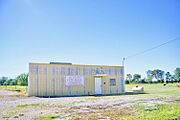
City Hall

See also
 In Spanish: Delaplaine (Arkansas) para niños
