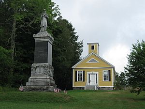
Dennysville, Maine facts for kids
Quick facts for kids
Dennysville, Maine
|
|
|---|---|

Dennysville Historic District, Dennysville
|
|
| Country | United States |
| State | Maine |
| County | Washington |
| Area | |
| • Total | 15.28 sq mi (39.58 km2) |
| • Land | 14.92 sq mi (38.64 km2) |
| • Water | 0.36 sq mi (0.93 km2) |
| Elevation | 177 ft (54 m) |
| Population
(2020)
|
|
| • Total | 300 |
| • Density | 20/sq mi (7.8/km2) |
| Time zone | UTC-5 (Eastern (EST)) |
| • Summer (DST) | UTC-4 (EDT) |
| ZIP code |
04628
|
| Area code(s) | 207 |
| FIPS code | 23-17355 |
| GNIS feature ID | 0582440 |
Dennysville is a small town in Maine, a state in the United States. It is located in Washington County. In 2020, about 300 people lived there.
Contents
History of Dennysville
Dennysville got its name from the nearby Dennys River. The first people to settle here were a group of sixteen men. They traveled by boat from a town called Hingham, Massachusetts. These early settlers arrived on the river's shore on May 17, 1786.
Geography of Dennysville
Dennysville is a town with both land and water areas. The total area of the town is about 15.28 square miles (39.58 square kilometers). Most of this area is land, about 14.92 square miles (38.64 square kilometers). A smaller part, about 0.36 square miles (0.93 square kilometers), is water.
Population in Dennysville
| Historical population | |||
|---|---|---|---|
| Census | Pop. | %± | |
| 1820 | 557 | — | |
| 1830 | 856 | 53.7% | |
| 1840 | 378 | −55.8% | |
| 1850 | 458 | 21.2% | |
| 1860 | 485 | 5.9% | |
| 1870 | 488 | 0.6% | |
| 1880 | 522 | 7.0% | |
| 1890 | 452 | −13.4% | |
| 1900 | 482 | 6.6% | |
| 1910 | 459 | −4.8% | |
| 1920 | 434 | −5.4% | |
| 1930 | 443 | 2.1% | |
| 1940 | 424 | −4.3% | |
| 1950 | 345 | −18.6% | |
| 1960 | 303 | −12.2% | |
| 1970 | 278 | −8.3% | |
| 1980 | 296 | 6.5% | |
| 1990 | 355 | 19.9% | |
| 2000 | 319 | −10.1% | |
| 2010 | 342 | 7.2% | |
| 2020 | 300 | −12.3% | |
| U.S. Decennial Census | |||
Dennysville Population in 2010
According to the census from 2010, there were 342 people living in Dennysville. These people lived in 154 different homes. About 96 of these homes were families.
The town had about 22.9 people living in each square mile. There were also 189 housing units. This means there were about 12.7 homes per square mile.
Most of the people in Dennysville were White (97.4%). A small number were Native American (0.6%). About 2.0% of the people were from two or more different backgrounds. Also, 1.8% of the population was Hispanic or Latino.
The average age of people in Dennysville was about 48.6 years old. About 19.9% of the residents were under 18 years old. About 19.6% were 65 years old or older. The town had slightly more females (53.2%) than males (46.8%).
See also
 In Spanish: Dennysville para niños
 | Selma Burke |
 | Pauline Powell Burns |
 | Frederick J. Brown |
 | Robert Blackburn |


