Dibble, Oklahoma facts for kids
Quick facts for kids
Dibble, Oklahoma
|
|
|---|---|

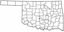
Location of Dibble, Oklahoma
|
|
| Country | United States |
| State | Oklahoma |
| County | McClain |
| Area | |
| • Total | 7.61 sq mi (19.70 km2) |
| • Land | 7.47 sq mi (19.34 km2) |
| • Water | 0.14 sq mi (0.37 km2) |
| Elevation | 1,188 ft (362 m) |
| Population
(2020)
|
|
| • Total | 867 |
| • Density | 116.13/sq mi (44.84/km2) |
| Time zone | UTC-6 (Central (CST)) |
| • Summer (DST) | UTC-5 (CDT) |
| ZIP code |
73031
|
| Area code(s) | 405 |
| FIPS code | 40-20650 |
| GNIS feature ID | 2412428 |
Dibble is a small town in McClain County, Oklahoma, United States. In 2020, about 867 people lived within its town limits. The area around Dibble, including its zip code 73031, has more residents, around 8,868 people.
Dibble is located west of Purcell, Oklahoma and southwest of Norman, Oklahoma. It is part of the larger Oklahoma City Metropolitan Area.
Contents
Geography
Dibble covers a total area of about 2.7 square miles (7.0 square kilometers), all of which is land.
The town is situated along State Highway 39. It is just east of where State Highway 39 meets State Highway 76.
History of Dibble
Dibble officially became a town in 1937. Its school system was first started in 1907.
Early Days and Name Origin
Dibble is in western McClain County, near State Highway 39 and State Highway 76. For a long time in the 1800s, this area was part of the Chickasaw Nation.
The town is named after John and James Dibble. They owned a ranch in the area. This ranch was a stopping point for soldiers and travelers on the Fort Smith to Fort Sill military road. The town may have existed as early as 1869. A post office was set up in Dibble in 1894.
Growth and Challenges
In 1901, a business guide reported that Dibble had about 100 residents. It had a hotel, a grocery store, a general store, a blacksmith, and a doctor. Ranching was the main business at first, followed by farming.
In 1902, the town's layout was planned. However, in 1906, the Oklahoma Central Railway decided not to build tracks through Dibble. Instead, the tracks were built eight miles north in Blanchard. This caused many businesses to leave Dibble.
By 1911, Dibble had about 150 people. It still had stores, a doctor, and a drugstore. In 1918, the population dropped to 125. But the town added a gristmill, a cotton gin, and a feed store. This showed that farming was still very important.
Modern Era
The post office in Dibble closed in 1926 but reopened in 1953. In 1936, the Works Progress Administration (WPA) helped build an addition to the school. This allowed more children from nearby areas to attend.
When State Highway 39 was finished in 1937, it ran right next to the town. This made it easier for the school district to include smaller rural schools. In 1940, Dibble had 97 people. The school, oil drilling, and farming continued to support the town.
The population slowly grew over the years. It was 127 in 1960 and 184 in 1970. By 2000, 289 people lived in Dibble. The Dibble School District had 568 students that year. In 2010, the town's population grew to 878 residents.
Population Changes
The population of Dibble has changed quite a bit over the years.
| Historical population | |||
|---|---|---|---|
| Census | Pop. | %± | |
| 1940 | 97 | — | |
| 1950 | 148 | 52.6% | |
| 1960 | 127 | −14.2% | |
| 1970 | 184 | 44.9% | |
| 1980 | 348 | 89.1% | |
| 1990 | 181 | −48.0% | |
| 2000 | 289 | 59.7% | |
| 2010 | 878 | 203.8% | |
| 2020 | 867 | −1.3% | |
| U.S. Decennial Census | |||
In 2000, there were 289 people living in Dibble. About 28% of the population was under 18 years old. The average age was 36 years old.
See also
 In Spanish: Dibble (Oklahoma) para niños
 | James Van Der Zee |
 | Alma Thomas |
 | Ellis Wilson |
 | Margaret Taylor-Burroughs |

