Dick's Knob facts for kids
Quick facts for kids Dick's Knob |
|
|---|---|

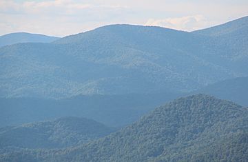
Dick's Knob viewed from Black Rock Mountain State Park
|
|
| Highest point | |
| Elevation | 4,620 ft (1,410 m) |
| Geography | |
| Location | Rabun County, Georgia, U.S. |
| Parent range | Blue Ridge Mountains |
| Topo map | USGS Hightower Bald |
| Climbing | |
| First ascent | unknown |
| Easiest route | Hike |
Dick's Knob is a mountain in the state of Georgia, USA. It is one of the highest peaks in Georgia, standing at about 4,620 feet (1,408 m) tall. You can find it in Rabun County, Georgia, inside a special protected area called the Southern Nantahala Wilderness. It's also the second-tallest mountain in Rabun County.
About Dick's Knob
Dick's Knob is part of the Chattahoochee National Forest. It sits on a place called Pot Gap Ridge, very close to the North Carolina border. The very top of the mountain, known as the summit, is about 0.5 miles (0.80 km) south of North Carolina. It's also about 2 miles (3.2 km) east of a small place called Tate City. The mountain is about 10 miles (16 km) northwest of the town of Clayton.
Nearby Nature
Around Dick's Knob, you can find other interesting natural spots. These include the Tallulah River, a well-known river in Georgia. Other mountains nearby are Standing Indian Mountain and Grassy Ridge. The rocks that make up Dick's Knob are very old. They are part of the southern Appalachian Mountains, which formed millions of years ago.
What's on Top?
The very top of Dick's Knob is covered by a special kind of forest. It's called a dwarfed oak forest. This means the oak trees there are smaller than usual. This is often because of the high elevation and tough weather conditions. In 2016, a large wildfire called the Rock Mountain Fire affected the summit of Dick's Knob.
Exploring Dick's Knob
If you like to hike, you should know that there are no official trails that go right over the top of Dick's Knob. However, experienced hikers can still reach the summit.
How to Hike There
- One way to reach Dick's Knob is to hike off the main path from the Appalachian Trail. You would start at a spot called Beech Gap and head south.
- Another way is to start from the Tate Branch Campground, which is near Tate City. From there, you would hike off-trail towards the east.
Remember, hiking off-trail requires good navigation skills and preparation.
 | William M. Jackson |
 | Juan E. Gilbert |
 | Neil deGrasse Tyson |

