Dirty Devil River facts for kids
Quick facts for kids Dirty Devil River |
|
|---|---|

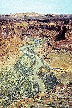
The Dirty Devil River near Twin Corral Box Canyon
|
|
|
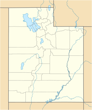
Location of the mouth of the Dirty Devil River in Utah
|
|
| Country | United States |
| State | Utah |
| County | Wayne County, Garfield County |
| Physical characteristics | |
| Main source | Confluence of Fremont River and Muddy Creek Wayne County, Utah 4,266 ft (1,300 m) 38°24′9″N 110°41′35″W / 38.40250°N 110.69306°W |
| River mouth | Colorado River Lake Powell, Glen Canyon National Recreation Area, Garfield County, Utah 3,703 ft (1,129 m) 37°53′30″N 110°23′33″W / 37.89167°N 110.39250°W |
| Length | 80 mi (130 km) |
| Basin features | |
| Tributaries |
|
The Dirty Devil River is a river in Utah, United States. It flows for about 80 miles (129 km). This river is a tributary, meaning it flows into a larger river. The Dirty Devil River joins the mighty Colorado River. It starts where two smaller rivers, the Fremont River and Muddy Creek, meet. Then it travels through southern Utah before reaching Lake Powell.
The River's Journey
The Dirty Devil River begins in Wayne County. This is near a town called Hanksville. It forms when the Fremont River and Muddy Creek combine. From there, it generally flows south.
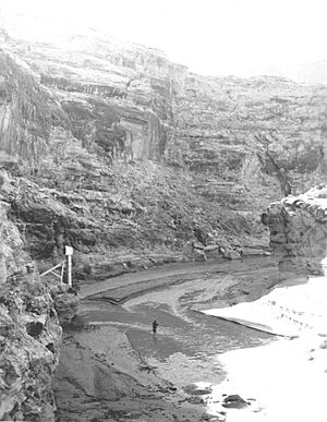
The river carves its way through a very deep canyon. This canyon can be as deep as 2,000 feet (610 meters)! It passes through Wayne and Garfield counties. The last 20 miles (32 km) of the river flow through Glen Canyon National Recreation Area. Here, it finally empties into the Colorado River. Today, this meeting point is underwater because of Lake Powell.
The canyon around the Dirty Devil River is quite remote. Not many people visit it compared to other natural areas nearby. The river's average flow is about 446 cubic feet per second.
River History
The Dirty Devil River got its name from an explorer named John Wesley Powell. He led an expedition in 1869. His team explored much of the Colorado River and its branches. Powell named this river because its water was very salty and muddy near where it joined the Colorado. He even named another, cleaner stream in the Grand Canyon "Bright Angel Creek" to show the difference.
In the 1890s, a famous group of people, sometimes called "outlaws," used the canyons that feed into the Dirty Devil River as a secret hiding place. One of these hideouts was known as Robbers Roost.
River Geology
The Dirty Devil River and its smaller streams add a lot of salt to the Colorado River each year. About 150,000 tons of salt come from this river system annually. A big part of this, about 86,000 tons, comes from the Muddy Creek alone. The Fremont River, however, does not add much salt.
There was a plan to reduce the salt in the Dirty Devil River. This plan involved collecting salty spring water. Then, this water would be put deep underground. The plan was finished in 1987. However, it has not been put into action.
Bridges Over the River
You can find a bridge crossing the Dirty Devil River a few miles northwest of the Hite Crossing Bridge. The Hite Crossing Bridge is a large steel arch bridge over the Colorado River. It is on State Route 95 in Garfield County.
Another bridge crosses the Dirty Devil River on Utah Highway 24. This bridge is a few miles northeast of Hanksville, Utah. It is located just downstream from where Muddy Creek and the Fremont River meet.
 | Shirley Ann Jackson |
 | Garett Morgan |
 | J. Ernest Wilkins Jr. |
 | Elijah McCoy |


