Fremont River (Utah) facts for kids
Quick facts for kids Fremont River |
|
|---|---|

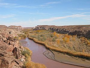
Looking south along the Fremont River near Caineville, February 2005
|
|
|
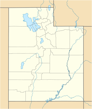
Location of the mouth of the Fremont River in Utah
|
|
| Country | United States |
| State | Utah |
| Region | Sevier and Wayne counties |
| Physical characteristics | |
| Main source | Johnson Valley Reservoir 8,819 ft (2,688 m) 38°36′32″N 111°37′56″W / 38.60889°N 111.63222°W |
| River mouth | Dirty Devil River near Hanksville 4,250 ft (1,300 m) 38°24′10″N 110°41′35″W / 38.40278°N 110.69306°W |
| Length | 95 mi (153 km) |
| Basin features | |
| Basin size | 751 sq mi (1,950 km2) |
The Fremont River is a 95-mile (153 km) long river in southeastern Utah, United States. It starts at the Johnson Valley Reservoir, which is near Fish Lake. The river flows southeast through Capitol Reef National Park. It then joins the Muddy Creek near Hanksville. Together, they form the Dirty Devil River, which eventually flows into the mighty Colorado River.
Where Does the Fremont River Flow?
The Fremont River begins its journey from the Johnson Valley Reservoir. This reservoir gets its water from two smaller streams: Sevenmile Creek and Lake Creek. As the river flows, it passes through several towns. These towns include Fremont, Loa, Lyman, Bicknell, Teasdale, and Torrey.
The river is very important for farming. It provides water all year long to help grow crops in the agricultural areas of Rabbit Valley and Caineville. After passing through these areas, the river continues towards Hanksville before reaching its end point.
Cool Facts About the Fremont River
The Fremont River collects water from a large area of about 751 square miles (1,945 km²). This area is called its drainage basin. The river gets its water mainly from melting snow. This snow comes from high mountains like Thousand Lake Mountain, Boulder Mountain, and the northern Henry Mountains.
The river is named after John C. Frémont, an American explorer. The river also gave its name to an ancient group of people. This group is known as the Fremont culture. They lived in this area long before Europeans arrived. Archaeologists study their history and way of life.
How Much Water Flows?
The amount of water flowing in the Fremont River changes throughout the year. At the Bicknell gauging station, the river's average flow is about 83.9 cubic feet per second (2.38 m³/s). This means that every second, about 83.9 cubic feet of water passes by.
The river usually has more water in the summer months, especially in July. This is often because of melting snow from the mountains. The lowest flows are typically in the fall, around September and October.
 | Bessie Coleman |
 | Spann Watson |
 | Jill E. Brown |
 | Sherman W. White |


