Discovery Bay (Australia) facts for kids
Quick facts for kids Discovery Bay |
|
|---|---|

West Victoria Coast, Bridgewater, Cape Nelson, Portland, Point Danger
|
|
| Location | Eastern South Australia and western Victoria |
| Coordinates | 38°03′S 140°52′E / 38.050°S 140.867°E |
| Type | An open oceanic embayment |
| Primary inflows | Glenelg River, Bridgewater Lakes |
| Primary outflows | Southern Ocean |
| Basin countries | Australia |
| Average depth | 30–60 m (98–197 ft) |
| Shore length1 | 70 km (43 mi) |
| Frozen | never |
| Settlements | Port MacDonnell |
| 1 Shore length is not a well-defined measure. | |
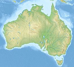
Discovery Bay is a large, open bay located on the coast of southeastern Australia. It stretches across parts of eastern South Australia and western Victoria.
Where is Discovery Bay Located?
Discovery Bay faces the mighty Southern Ocean. It is about 70 kilometers (43 miles) long. The bay starts near Port MacDonnell in South Australia. It reaches all the way to Cape Bridgewater in Victoria. Cape Northumberland, a point in South Australia, is the southernmost part of the mainland there. The Glenelg River flows into the bay near the town of Nelson.
Who Named Discovery Bay?
A famous explorer named Thomas Mitchell gave the bay its name. He explored the area on August 20, 1836. He came down the Glenelg River and found this beautiful bay.
Protected Areas in Discovery Bay
Parts of Discovery Bay are protected areas. These areas help keep the natural environment safe.
- The South Australian coastline of the bay is part of the Lower South East Marine Park.
- The Victorian coastline is protected within the Discovery Bay Coastal Park.
- The waters near Cape Bridgewater are part of the Discovery Bay Marine National Park. These parks help protect the plants and animals that live there.
 | Delilah Pierce |
 | Gordon Parks |
 | Augusta Savage |
 | Charles Ethan Porter |


