
Doña Ana, New Mexico facts for kids
Quick facts for kids
Doña Ana, New Mexico
|
|
|---|---|

Doña Ana Community Center, July 2009
|
|

Location within Doña Ana County and New Mexico
|
|
| Country | United States |
| State | New Mexico |
| County | Doña Ana |
| Area | |
| • Total | 0.64 sq mi (1.65 km2) |
| • Land | 0.64 sq mi (1.65 km2) |
| • Water | 0.00 sq mi (0.00 km2) |
| Elevation | 3,963 ft (1,208 m) |
| Population
(2020)
|
|
| • Total | 874 |
| • Density | 1,367.76/sq mi (528.38/km2) |
| Time zone | Mountain (MST) |
| ZIP code |
88032
|
| Area code | 575 |
| FIPS code | 35-21110 |
| GNIS feature ID | 2408681 |
Doña Ana is a small community in Doña Ana County, New Mexico, United States. It is known as a census-designated place (CDP). This means it's an area identified by the United States Census Bureau for collecting population data. In 2020, about 874 people lived there.
Contents
History of Doña Ana
Doña Ana gets its name from a woman named Doña Ana Robledo. She passed away in 1680 while trying to escape during the Pueblo Revolt.
Early Settlement and Life
In 1846, a British traveler named George Frederick Ruxton visited Doña Ana. He described it as a very new settlement. Only about ten to fifteen families lived there at the time.
These families were drawn to the rich soil. They left their farms in the El Paso valley to grow crops here. Their homes were simple huts made of logs and mud. They were built on a flat-topped hill overlooking the Rio Grande River.
The settlers faced challenges from the Apache people. The Apache sometimes visited and took or destroyed their farm animals.
Where is Doña Ana Located?
Doña Ana is found near the middle of Doña Ana County. It is right next to Interstate 25. You can get there from Exit 9.
Travel and Nearby Cities
Interstate 25 is a major highway. If you drive south on I-25 for about 6 miles (10 km), you will reach Las Cruces. If you head northwest for about 33 miles (53 km), you will arrive in Hatch.
The community covers a total area of about 0.64 square miles (1.65 square kilometers). All of this area is land, with no large bodies of water.
Who Lives in Doña Ana?
| Historical population | |||
|---|---|---|---|
| Census | Pop. | %± | |
| 2020 | 874 | — | |
| U.S. Decennial Census | |||
Doña Ana is part of the larger Las Cruces area. This area is known as a Metropolitan Statistical Area, which means it's a region with a large population and close economic ties.
Population Details
According to the 2000 census, there were 1,379 people living in Doña Ana. There were 447 households and 363 families. The population density was about 1,885 people per square mile.
Many different groups of people live in Doña Ana. About 87% of the population identified as Hispanic or Latino. Other groups included White, Black, Native American, and Asian people.
Families and Age Groups
About 40% of households had children under 18 living with them. Many households were married couples. Some households had a female head with no husband present.
The average household had about 3 people. The average family had about 3.4 people. The community has a mix of age groups. About 30% of the population was under 18 years old. The median age was 31 years.
Income Information
In 2000, the average income for a household in Doña Ana was about $27,292 per year. For families, the average income was about $32,685. The income per person was about $10,542.
Some people in Doña Ana lived below the poverty line. This included about 23% of the total population. About 26% of those under 18 and 44% of those 65 or older were in this group.
Education in Doña Ana
Students in Doña Ana attend schools that are part of the Las Cruces Public Schools district. This district serves many communities in the area.
Images for kids
-
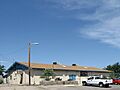
Doña Ana Community Center, July 2009
-
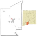
Location within Doña Ana County and New Mexico
See also
 In Spanish: Doña Ana (Nuevo México) para niños
