Dollar Point, California facts for kids
Quick facts for kids
Dollar Point, California
|
|
|---|---|

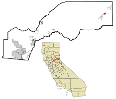
Location in Placer County and the State of California
|
|
| Country | |
| State | |
| County | |
| Area | |
| • Total | 1.84 sq mi (4.78 km2) |
| • Land | 1.64 sq mi (4.23 km2) |
| • Water | 0.21 sq mi (0.54 km2) 0% |
| Elevation | 6,424 ft (1,958 m) |
| Population
(2020)
|
|
| • Total | 1,261 |
| • Density | 771.25/sq mi (297.76/km2) |
| Time zone | UTC-8 (PST) |
| • Summer (DST) | UTC-7 (PDT) |
| ZIP code |
96145
|
| Area code(s) | 530 |
| FIPS code | 06-19455 |
| GNIS feature ID | 2408680 |
Dollar Point is a small community in Placer County, California, United States. It is located right on the beautiful northwest shore of Lake Tahoe. This area is considered part of the larger Sacramento region. In 2020, about 1,261 people lived here.
Contents
History of Dollar Point
Dollar Point has an interesting past, especially with its connection to the logging industry and railways. In 1884, a company called Glenbrook Mills cut down trees on 337 acres of land here. Later, in 1898, the Lake Tahoe Railway and Transportation Company built a special narrow gauge railway track. This track was about 16 miles (26 km) long and went into the area that became known as Dollar Point.
The Southern Pacific railway company took over the tracks in 1925. They changed the tracks to a wider size in 1926. Southern Pacific bought the property in 1933 but stopped using the tracks in 1943.
In 1916, a woman named Lora Josephine Knight bought this land. The area was originally called Chinquapin by the Washoe Indians. Later, in 1927, a man named Robert Dollar bought the land from Lora Knight. He bought many properties, and this area was sometimes called "Old Lousy" or "Observatory Point" before he owned it. Lora Knight became famous for building the beautiful Vikingsholm Castle in 1929, which is still a popular place to visit. She and her husband also helped Charles Lindbergh pay for his famous non-stop flight across the Atlantic Ocean.
Dollar Point is located in the Sierra Nevada Mountain Range. It sits on the northwest side of Lake Tahoe. Nearby communities include Carnelian Bay to the north and Tahoe City to the south. The Tahoe National Forest and Burton Creek State Park are also close by. State Route 28 is the main road that goes through Dollar Point.
Geography of Dollar Point
Two creeks flow near Dollar Point. Dollar Creek runs along the northern edge of the area. It also has a reservoir called Dollar reservoir. Burton Creek flows along the southern edge.
According to the United States Census Bureau, Dollar Point covers about 1.6 square miles (4.1 square kilometers) of land. There is no water area within the official boundaries of the community itself.
Population and People
| Historical population | |||
|---|---|---|---|
| Census | Pop. | %± | |
| 2020 | 1,261 | — | |
| U.S. Decennial Census | |||
Population in 2010
In 2010, the population of Dollar Point was 1,215 people. Most of the people living there were White (94.2%). A small number of people were African American, Native American, or Asian. About 6.8% of the population identified as Hispanic or Latino.
There were 571 homes in Dollar Point. About 19.1% of these homes had children under 18 living in them. Many homes were families, including married couples. The average number of people living in each home was about 2.13.
The ages of the people in Dollar Point varied. About 15.5% of the population was under 18 years old. About 16.1% were 65 years or older. The average age of people in Dollar Point was 45.4 years.
Population in 2000
In 2000, Dollar Point had a population of 1,539 people. This was more than in 2010. The community had 681 homes at that time.
See also
 In Spanish: Dollar Point para niños


