Dollarhide Mountain facts for kids
Quick facts for kids Dollarhide Mountain |
|
|---|---|
| Highest point | |
| Elevation | 9,301 ft (2,835 m) |
| Prominence | 481 ft (147 m) |
| Geography | |
| Location | Blaine and Camas counties, Idaho, U.S. |
| Parent range | Smoky Mountains |
| Topo map | USGS Dollarhide Mountain |
| Climbing | |
| Easiest route | Simple scramble, class 2 |
Dollarhide Mountain is a tall mountain peak in Idaho, United States. It stands 9,301 feet (which is about 2,835 meters) above the level of the sea. This mountain is part of the beautiful Smoky Mountains range.
Where is Dollarhide Mountain?
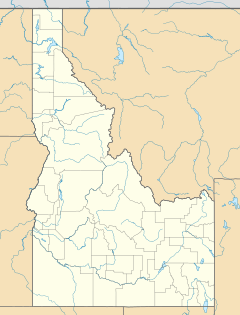
Dollarhide Mountain is located in the central part of Idaho. It sits right on the border between two counties: Blaine County and Camas County. The mountain is also inside the large Sawtooth National Forest. This forest is a protected area with many trees and wildlife.
It is not far from another peak called Baker Peak. Dollarhide Mountain is about 4.2 miles (6.8 kilometers) south of Baker Peak.
Getting to Dollarhide Mountain
There is a forest road, called Forest Road 227, that goes near Dollarhide Mountain. This road crosses a high point known as Dollarhide Summit. However, there are no roads or trails that go all the way to the very top of Dollarhide Mountain.
If you want to reach the summit, you would need to do a "simple scramble." This means climbing over rocks and uneven ground using your hands and feet. It is considered an easy climb for experienced hikers.


