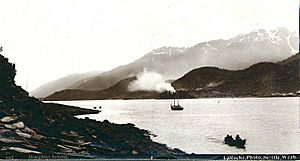
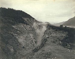
Douglas Island facts for kids
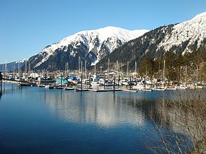
Douglas Island is an island in the U.S. state of Alaska. It is part of the city and borough of Juneau. The island sits just west of downtown Juneau. It is separated from mainland Juneau by the Gastineau Channel. Douglas Island is home to the communities of Douglas and West Juneau.
History of Douglas Island
Douglas Island was named for John Douglas. He was a bishop from Salisbury, England. Captain George Vancouver gave the island its name. Joseph Whidbey, who was on Vancouver's ship HMS Discovery, first saw the island in 1794.
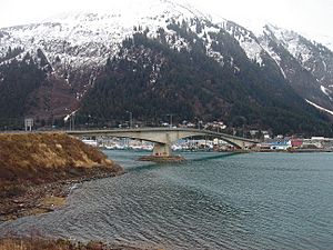
The Juneau-Douglas Bridge connects Douglas Island with Juneau. This bridge has two lanes for cars and also allows people to walk across. There have been ideas to build another bridge. This new bridge would go from North Douglas to the Mendenhall Valley.
Exploring Douglas Island's Geography
Admiralty Island is located to the west and south of Douglas Island. The Stephens Passage is a body of water that separates them.
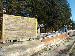
Douglas Island has many interesting features. You can find the remains of the Treadwell gold mine here. There is also Sandy Beach, which is the only sand beach in the Juneau area. This beach was made from leftover materials from the mine. Other places include Eaglecrest Ski Area, Perseverance Theatre, and the Douglas Public Library.
Douglas Island is a "tidal island." This means it connects to the mainland at its north end during low tide. When the water is low, Douglas Island is connected to Juneau's Twin Lakes area. It also connects to the Juneau International Airport and other spots.
People usually think of Douglas Island as two main areas. There's downtown Douglas 58°16′32″N 134°23′33″W / 58.27556°N 134.39250°W. This area includes West Juneau 58°17′42″N 134°25′46″W / 58.29500°N 134.42944°W. It has Douglas Harbor, Sandy Beach, the old mines, the library, and the bridge to Juneau. Then there's North Douglas Island. This part has a place for storing oil, the Eaglecrest Ski Area, and a heliport.
The island covers an area of about 76.93 square miles (199.2 square kilometers). In the year 2000, about 5,297 people lived there. More than half of these people lived in the main Douglas area. The island's highest point is Mount Ben Stewart. It was named after Benjamin D. Stewart, who was an early mayor of Juneau.
Important People from Douglas Island
Douglas Island has been home to many important people in Juneau's politics. For example, Merrill Sanford, a former mayor of Juneau, lived there. Byron Mallott, who was a former lieutenant governor of Alaska, also lived on the island. Dennis Egan, who represented Juneau in the Alaska Senate, lived in West Juneau.
Other important leaders from Douglas Island include Sally Smith, another former mayor, and Bruce Botelho, who also served as mayor. Beth Kerttula, who was a representative in the Alaska House of Representatives, lived in North Douglas. Even the first Juneau-based justice of the Alaska Supreme Court, John H. Dimond, lived in Douglas. His successor, Robert Boochever, also lived nearby. This shows how many leaders have come from Douglas Island.
 | Janet Taylor Pickett |
 | Synthia Saint James |
 | Howardena Pindell |
 | Faith Ringgold |


