
Douglas Municipal Airport (Arizona) facts for kids
Quick facts for kids
Douglas Municipal Airport
|
|||||||||||||||
|---|---|---|---|---|---|---|---|---|---|---|---|---|---|---|---|

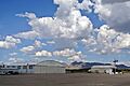
2006 USGS photo
|
|||||||||||||||
| Summary | |||||||||||||||
| Airport type | Public | ||||||||||||||
| Owner | City of Douglas | ||||||||||||||
| Serves | Douglas, Arizona | ||||||||||||||
| Elevation AMSL | 4,173 ft / 1,272 m | ||||||||||||||
| Coordinates | 31°20′33″N 109°30′23″W / 31.34250°N 109.50639°W | ||||||||||||||
| Map | |||||||||||||||

KDGL
Location in Arizona
|
|||||||||||||||
| Runway | |||||||||||||||
|
|||||||||||||||
| Statistics (2005) | |||||||||||||||
|
|||||||||||||||
|
Source: Federal Aviation Administration
|
|||||||||||||||
|
Douglas Municipal Airport
|
|
| Lua error in Module:Location_map at line 420: attempt to index field 'wikibase' (a nil value). | |
| Location | E end of 10th Ave., Douglas, Arizona |
|---|---|
| Area | 221.8 acres (89.8 ha) |
| Built | 1928 |
| NRHP reference No. | 75000336 |
| Added to NRHP | December 30, 1975 |
Douglas Municipal Airport (DGL, KDGL, DGL) is a public airport located about 2 miles (3.7 km) east of the center of Douglas. Douglas is a city in Cochise County, Arizona, United States. The city of Douglas owns this airport.
Currently, no big commercial airlines fly to Douglas Municipal Airport. It is mostly used by smaller, private planes. An interesting fact is that one end of runway 21 is only about 800 feet (244 meters) from the Mexico–United States border!
Airport Features and Planes
Douglas Municipal Airport covers a large area of about 640 acres (259 hectares). This space includes two main runways for planes to take off and land.
- Runway 3/21 has a hard asphalt surface. It is 5,760 feet (1,756 meters) long and 75 feet (23 meters) wide.
- Runway 18/36 has a dirt surface. It is 4,095 feet (1,248 meters) long and 100 feet (30 meters) wide.
In the year leading up to July 31, 2005, the airport had 7,500 general aviation flights. This means there were about 20 plane takeoffs or landings each day. General aviation includes private planes, business jets, and other non-commercial flights.
History of Douglas Municipal Airport
Douglas Municipal Airport was built in 1928. It has been an important part of the area's history. Because of its historical value, the airport was added to the National Register of Historic Places on December 30, 1975. This means it is recognized as a place worth preserving. The historic area covers about 221.8 acres (89.76 hectares).
Images for kids
-
An aerial view of Douglas Municipal Airport.

See also
 In Spanish: Aeropuerto Municipal de Douglas para niños
