
Drakesboro, Kentucky facts for kids
Quick facts for kids
Drakesboro, Kentucky
|
|
|---|---|

Drakesboro
|
|

Location in Muhlenberg County, Kentucky
|
|
| Country | United States |
| State | Kentucky |
| County | Muhlenberg |
| Area | |
| • Total | 0.56 sq mi (1.45 km2) |
| • Land | 0.55 sq mi (1.43 km2) |
| • Water | 0.01 sq mi (0.02 km2) |
| Elevation | 443 ft (135 m) |
| Population
(2020)
|
|
| • Total | 481 |
| • Density | 871.38/sq mi (336.45/km2) |
| Time zone | UTC-6 (Central (CST)) |
| • Summer (DST) | UTC-5 (CDT) |
| ZIP code |
42337
|
| Area code(s) | 270 |
| FIPS code | 21-22348 |
| GNIS feature ID | 0491099 |
Drakesboro is a small city in Muhlenberg County, Kentucky, in the United States. It's known as a "home rule-class city," which means it has the power to govern itself locally. In 2020, about 481 people lived there. The city was officially started in 1888. It was named after an early settler, William Drake.
Contents
Geography
Drakesboro is located in the eastern part of Muhlenberg County. You can find it at these coordinates: 37°13′2″N 87°3′1″W / 37.21722°N 87.05028°W. The city is along Kentucky Route 176, also called Mose Rager Boulevard. This road is east of Greenville, which is the main town of the county.
The city's borders reach east to where Kentucky Route 176 meets U.S. Route 431. Greenville is about 7 miles (11 km) to the west. Central City is about 7 miles (11 km) to the northwest if you take US 431. Russellville is about 29 miles (47 km) to the south.
Drakesboro covers about 0.56 square miles (1.45 square kilometers) in total. Most of this area is land, with only a small part, about 0.01 square miles (0.02 square kilometers), being water. Plum Creek flows along the eastern side of the city. It then goes north into Pond Creek, which continues north to the Green River. The Green River is south of Rockport.
Demographics
| Historical population | |||
|---|---|---|---|
| Census | Pop. | %± | |
| 1900 | 228 | — | |
| 1910 | 1,126 | 393.9% | |
| 1920 | 1,164 | 3.4% | |
| 1930 | 1,242 | 6.7% | |
| 1940 | 1,255 | 1.0% | |
| 1950 | 1,102 | −12.2% | |
| 1960 | 832 | −24.5% | |
| 1970 | 907 | 9.0% | |
| 1980 | 798 | −12.0% | |
| 1990 | 565 | −29.2% | |
| 2000 | 627 | 11.0% | |
| 2010 | 515 | −17.9% | |
| 2020 | 481 | −6.6% | |
| U.S. Decennial Census | |||
In 2000, there were 627 people living in Drakesboro. Most people were White, making up about 89% of the population. About 10% were African American. A very small number of people were Native American or Asian. Some people were also from two or more races. Less than 1% of the population was Hispanic or Latino.
The population included people of all ages. About 30% of the people were under 18 years old. About 12% were 65 years or older. The average age in the city was 34 years old.
Sites of interest
Drakesboro has a few interesting places to visit.
The Four Legends Fountain
The Four Legends Fountain was built in 1992. It honors four famous musicians who were pioneers of a special guitar style called "thumb picking." This style is often heard in bluegrass music. The four musicians honored are Kennedy Jones, Ike Everly, Mose Rager, and Merle Travis. All of them had strong connections to Muhlenberg County.
John Prine Highway
A part of Highway 431 that goes through Drakesboro is named after John Prine. He was a famous American folk and country singer-songwriter.
Notable people
- Mose Rager, a talented musician.
- Merle Travis, a well-known country western songwriter and performer.
Images for kids
-
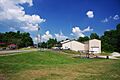
Drakesboro City Hall and park
See also
 In Spanish: Drakesboro (Kentucky) para niños
