Dudidontu River facts for kids
Quick facts for kids Dudidontu River |
|
|---|---|
|
Mouth of Dudidontu River
|
|
| Country | Canada |
| Province | British Columbia |
| District | Cassiar Land District |
| Physical characteristics | |
| Main source | Level Mountain Range Nahlin Plateau 1,710 m (5,610 ft) 58°24′12″N 131°26′54″W / 58.40333°N 131.44833°W |
| River mouth | Nahlin River 387 m (1,270 ft) 58°47′22″N 131°59′5″W / 58.78944°N 131.98472°W |
| Length | 112 km (70 mi) |
| Basin features | |
| Basin size | 964 km2 (372 sq mi), |
| Topo maps | NTS 104J5 Ketchum Lake NTS 104J6 Beatty Creek NTS 104J13 Prairie Lake NTS 104J12 Dididontu River |
The Dudidontu River is a cool river in British Columbia, Canada. It's a tributary (a smaller stream that flows into a larger one) of the Nahlin River. The Nahlin River then joins the Inklin River, which is a big part of the Taku River system.
The Dudidontu River's watershed (the area of land that drains into it) is about 964 km2 (372 sq mi). Its average water flow is about 15.4 m3/s (540 cu ft/s). Almost half of the water in the Dudidontu comes from its main side streams, Kakuchuya Creek and Matsatu Creek.
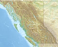
The river's mouth is located about 150 km (93 mi) northeast of Juneau, Alaska. It is also about 110 km (68 mi) northwest of Telegraph Creek, British Columbia. The Dudidontu River flows through the traditional lands of the Taku River Tlingit First Nation, who are part of the Tlingit people.
Contents
River's Journey: Where Does the Dudidontu Flow?
The Dudidontu River starts in the Level Mountain Range. This area is part of the Nahlin Plateau. It begins near the sources of the Little Tahltan River and Egnell Creek.
From its start, the river flows west through a wide, U-shaped valley. Then it turns south. It passes by Ketchum Lake. After that, the Dudidontu River flows mostly north for the rest of its journey. The river is about 112 km (70 mi) long in total.
Key Features Along the Way
The river flows between Level Mountain and the Heart Peaks. It also passes by Camp Island Lake. Two important streams, Kakuchuya Creek and Matsatu Creek, join the Dudidontu. Both of these creeks flow from Level Mountain.
The middle part of the Dudidontu River is very interesting. From Camp Island Lake to about 6.4 km (4.0 mi) below Kakuchuya Creek, the river winds through a wide, flat area. This area is great for Chinook salmon to lay their eggs.
The Lower Dudidontu: A Challenging Section
Below this calm section, the lower Dudidontu River changes. It flows through a 19.2 km (11.9 mi) long canyon. This canyon has very steep slopes made of mud, rocks, and shale. There are no plants growing on these slopes. This part of the river has many strong rapids, one after another.
What's Around the River?
The land around the Dudidontu River is mostly covered by different types of plants. About 37.9% of the land is shrubland. This means it's covered in bushes and small trees. Another 25.3% is conifer forest, which has trees like pines and spruces. About 22.6% of the land is barren, meaning it has very few plants. The rest is made up of small amounts of other types of land cover.
See also
 | Victor J. Glover |
 | Yvonne Cagle |
 | Jeanette Epps |
 | Bernard A. Harris Jr. |


