Dululu facts for kids
Quick facts for kids DululuQueensland |
|||||||||||||||
|---|---|---|---|---|---|---|---|---|---|---|---|---|---|---|---|

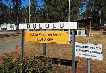
Dululu Rest Area, 2014
|
|||||||||||||||
| Population | 97 (2021 census) | ||||||||||||||
| • Density | 0.662/km2 (1.71/sq mi) | ||||||||||||||
| Postcode(s) | 4702 | ||||||||||||||
| Area | 146.6 km2 (56.6 sq mi) | ||||||||||||||
| Time zone | AEST (UTC+10:00) | ||||||||||||||
| Location |
|
||||||||||||||
| LGA(s) | Shire of Banana | ||||||||||||||
| State electorate(s) | Callide | ||||||||||||||
| Federal Division(s) | Flynn | ||||||||||||||
|
|||||||||||||||
Dululu is a small country town in Queensland, Australia. It is located in the Shire of Banana. In 2021, only 97 people lived there.
Contents
Where is Dululu?
Dululu is in Central Queensland. It sits where the Burnett and Leichhardt highways meet. It is about 70 kilometers (43 miles) south-west of Rockhampton, Queensland. The state capital, Brisbane, is about 610 kilometers (379 miles) to the north-west.
Nearby Areas
Dululu has a few smaller areas within it. These are called neighbourhoods.
- Boogargan
- Bunerba
- Littles Crossing
Old Railway Line
The old Dawson Valley (Theodore) railway line used to go through Dululu. There were two train stations that are now closed.
- Boogargan railway station
- Dululu railway station, which served the town
Dululu's History
The town was first called Bunerba. But on April 29, 1915, the Queensland Railways Department changed the name. They wanted to avoid confusion with another town called Buneru. So, they named the new railway station Dululu. This name comes from an Indigenous word meaning "soft."
Schools in the Past
Several schools opened and closed in the Dululu area over the years.
- Alma Creek State School was open from 1915 to 1935.
- Dululu State School opened around August 1916. It closed on April 11, 1968.
- Bunerba Provisional School opened in February 1922. It became Bunerba State School in 1924. This school closed on December 13, 1996.
Post Office
A post office opened in Dululu by 1920. Before that, there was a smaller "receiving office" from 1915.
Population Changes
The number of people living in Dululu has changed over time.
- In 2011, there were 139 people.
- In 2016, the population was 126 people.
- By 2021, the population was 97 people.
Education Today
There are no schools directly in Dululu today. Students usually go to schools in nearby towns.
- The closest primary school is Wowan State School. It is in Wowan, to the south-west.
- For high school, students can go to Mount Morgan State High School. This school is in Mount Morgan, to the north-east.
Local Amenities
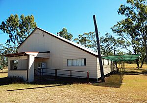
The Dululu Hall is an important community building. It is located on Bryant Street.


