Durham, Oregon facts for kids
Quick facts for kids
Durham, Oregon
|
||
|---|---|---|

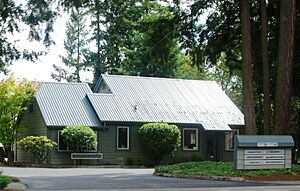
City hall
|
||
|
||

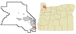
Location in Oregon
|
||
| Country | United States | |
| State | Oregon | |
| County | Washington | |
| Incorporated | 1966 | |
| Area | ||
| • Total | 0.41 sq mi (1.06 km2) | |
| • Land | 0.41 sq mi (1.06 km2) | |
| • Water | 0.00 sq mi (0.00 km2) | |
| Elevation | 200 ft (60 m) | |
| Population
(2020)
|
||
| • Total | 1,944 | |
| • Density | 4,741.46/sq mi (1,832.36/km2) | |
| Time zone | UTC-8 (Pacific) | |
| • Summer (DST) | UTC-7 (Pacific) | |
| ZIP code |
97224
|
|
| Area code(s) | 503 and 971 | |
| FIPS code | 41-21250 | |
| GNIS feature ID | 2410376 | |
| Website | www.durham-oregon.us | |
Durham is a small city in Washington County, Oregon, United States. It became an official city in 1966. Durham is surrounded by the cities of Tigard and Tualatin. It is also very close to the Bridgeport Village shopping center. In 2020, about 1,944 people lived in Durham.
History of Durham
The city of Durham is named after Albert Alonzo Durham. He was the person who started the nearby city of Lake Oswego. Albert Durham ran a sawmill and a flour mill in this area. These mills were located on Fanno Creek, which still flows through the city today. He operated them from 1866 until he passed away in 1898.
This area was first known as Durhams Mills. It was located along the Boones Ferry Road, which led to Portland. In 1908, the Oregon Electric Railway added a train stop here. They called this stop Durham.
In 1966, the people living in Durham voted to make it an official city. They did this to protect their homes. They wanted to stop factories and businesses from taking over their residential areas. Today, Durham is mostly a place where people live.
Geography of Durham
Durham is a small city, covering about 0.41 square miles (1.06 square kilometers). All of this area is land. The city is located about 200 feet (61 meters) above sea level.
The main road that goes through Durham is Upper Boones Ferry Road. Interstate 5, a major highway, is about 0.5 miles (0.8 km) east of the city. The Tualatin River forms part of the western border of Durham. Durham City Park is also located on the western edge of the city.
People in Durham
| Historical population | |||
|---|---|---|---|
| Census | Pop. | %± | |
| 1970 | 410 | — | |
| 1980 | 707 | 72.4% | |
| 1990 | 748 | 5.8% | |
| 2000 | 1,382 | 84.8% | |
| 2010 | 1,351 | −2.2% | |
| 2020 | 1,944 | 43.9% | |
| U.S. Decennial Census | |||
According to the census from 2010, there were 1,351 people living in Durham. These people lived in 545 households. The city had about 3,295 people per square mile (1,272 people per square kilometer).
The average household in Durham had about 2.48 people. The average family size was about 2.95 people. The median age in the city was 38.1 years old. About 24.1% of the people were under 18 years old. About 10.3% of the people were 65 years old or older. The population was almost evenly split between males (48.3%) and females (51.7%).
See also
 In Spanish: Durham (Oregón) para niños
 | Tommie Smith |
 | Simone Manuel |
 | Shani Davis |
 | Simone Biles |
 | Alice Coachman |


