Dyer, Arkansas facts for kids
Quick facts for kids
Dyer, Arkansas
|
|
|---|---|

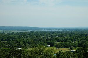
Outskirts of Dyer with Arkansas River in the background, July 2005
|
|

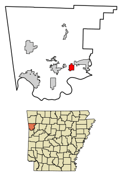
Location of Dyer in Crawford County, Arkansas.
|
|
| Country | United States |
| State | Arkansas |
| County | Crawford |
| Area | |
| • Total | 2.94 sq mi (7.62 km2) |
| • Land | 2.94 sq mi (7.62 km2) |
| • Water | 0.00 sq mi (0.00 km2) |
| Elevation | 430 ft (130 m) |
| Population
(2020)
|
|
| • Total | 772 |
| • Density | 262.50/sq mi (101.36/km2) |
| Time zone | UTC-6 (Central (CST)) |
| • Summer (DST) | UTC-5 (CDT) |
| ZIP code |
72935
|
| Area code(s) | 479 |
| FIPS code | 05-20200 |
| GNIS feature ID | 2403523 |
Dyer is a small city located in Crawford County, Arkansas, in the United States. It is part of the larger Fort Smith, Arkansas area, which includes parts of both Arkansas and Oklahoma. In 2020, about 772 people lived in Dyer.
Contents
Discovering Dyer's Past
Dyer was officially planned and laid out in 1884. This happened soon after the Little Rock and Fort Smith Railroad built its tracks through the area. The city got its name from the local Dyer family. S. M. Dyer bought the land where the town now stands in 1870. A post office has been helping people send mail in Dyer since 1885.
Where is Dyer Located?
Dyer is found in the southeastern part of Crawford County. It sits in the beautiful valley of the Arkansas River. A main road, U.S. Route 64, goes right through the city. If you travel west on this road for about 5 miles (8 km), you will reach Alma. Going about 13 miles (21 km) west will take you to Van Buren, which is the main city of Crawford County. If you head east on Route 64 for about 5 miles (8 km), you will arrive in Mulberry.
Interstate 40, a major highway, also passes through the northern part of Dyer. However, there isn't a direct exit for Dyer from this highway. The closest way to get on or off Interstate 40 is from Exit 20, which is in the western part of Mulberry.
The United States Census Bureau says that Dyer covers a total area of about 2.94 square miles (7.62 square kilometers). All of this area is land, meaning there are no large lakes or rivers within the city limits.
Who Lives in Dyer?
The number of people living in Dyer has changed over the years. Here is a quick look at how the population has grown and shrunk:
| Historical population | |||
|---|---|---|---|
| Census | Pop. | %± | |
| 1900 | 343 | — | |
| 1910 | 433 | 26.2% | |
| 1920 | 609 | 40.6% | |
| 1930 | 425 | −30.2% | |
| 1940 | 513 | 20.7% | |
| 1950 | 398 | −22.4% | |
| 1960 | 450 | 13.1% | |
| 1970 | 486 | 8.0% | |
| 1980 | 608 | 25.1% | |
| 1990 | 502 | −17.4% | |
| 2000 | 585 | 16.5% | |
| 2010 | 876 | 49.7% | |
| 2020 | 772 | −11.9% | |
| U.S. Decennial Census | |||
Dyer's Population in 2020
In 2020, the 2020 United States census counted 772 people living in Dyer. There were 277 households and 211 families in the city. Most of the people living in Dyer are White, making up about 86.66% of the population. Other groups include Black or African American, Native American, Asian, and people of mixed races. About 4.79% of the population identified as Hispanic or Latino.
See also
 In Spanish: Dyer (Arkansas) para niños
 | Roy Wilkins |
 | John Lewis |
 | Linda Carol Brown |

