Dynamite, Washington facts for kids
Quick facts for kids
Dynamite
|
|
|---|---|
| Country | United States |
| State | Washington |
| County | Spokane |
| Elevation | 2,333 ft (711 m) |
| Time zone | UTC-8 (Pacific (PST)) |
| • Summer (DST) | UTC-7 (PDT) |
| GNIS feature ID | 1510923 |
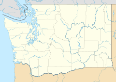
Dynamite is a small place in Spokane County, Washington, in the United States. It is called an "unincorporated community." This means it's a place where people live, but it doesn't have its own local government like a city or town.
Contents
Discovering Dynamite
Where is Dynamite Located?
Dynamite sits at an elevation of 2,333 feet above sea level. It is about 13 miles south of Downtown Spokane. This area is part of the Channeled Scablands. The Channeled Scablands are unique landscapes formed by ancient floods.
What's Around Dynamite?
There isn't a busy town center or a lot of buildings close together in Dynamite. The area around it is mostly covered by forests or used for farming. Houses are spread out, with plenty of space between them. A special place called the James T. Slavin Conservation Area is just a few miles north of Dynamite. This area helps protect nature.
Roads Near Dynamite
You can find clues about Dynamite's location from nearby roads. Two roads in the area are named Dynamite Lane and Blasted Lane. These names hint at the community's general spot. Also, U.S. Route 195 is a major highway that passes about two miles east of Dynamite. This highway goes north to Spokane and south through a farming region called the Palouse all the way to Lewiston, Idaho.
 | John T. Biggers |
 | Thomas Blackshear |
 | Mark Bradford |
 | Beverly Buchanan |


