East Brady, Pennsylvania facts for kids
Quick facts for kids
East Brady, Pennsylvania
|
||
|---|---|---|
|
Borough
|
||
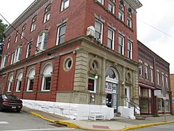
A street in East Brady
|
||
|
||
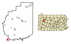
Location of East Brady in Clarion County, Pennsylvania.
|
||
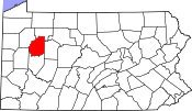
Map showing Clarion County in Pennsylvania
|
||
| Country | United States | |
| State | Pennsylvania | |
| County | Clarion | |
| Settled | 1854 | |
| Platted | 1866 | |
| Incorporated | 1869 | |
| Government | ||
| • Type | Borough Council | |
| Area | ||
| • Total | 1.11 sq mi (2.87 km2) | |
| • Land | 0.81 sq mi (2.10 km2) | |
| • Water | 0.30 sq mi (0.77 km2) | |
| Elevation | 960 ft (290 m) | |
| Population
(2020)
|
||
| • Total | 818 | |
| • Density | 1,011.12/sq mi (390.37/km2) | |
| Time zone | UTC-5 (Eastern (EST)) | |
| • Summer (DST) | UTC-4 (EDT) | |
| ZIP code |
16028
|
|
| FIPS code | 42-20840 | |
East Brady is a small town, known as a borough, located in Clarion County, Pennsylvania, United States. In 2020, about 822 people lived there. It's a quiet place with a rich history. You can learn more about the area by visiting Discover Clarion County.
Contents
History of East Brady
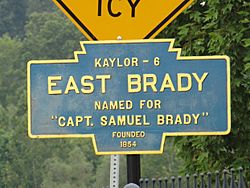
East Brady got its name from a brave person named Captain Samuel Brady. He was a well-known figure in the area's early days. The town was officially started in 1866 and became a borough in 1869.
Geography and Location
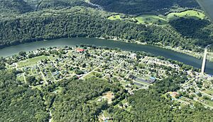
East Brady is in the southwest part of Clarion County. It sits right next to a bend in the Allegheny River. This river flows about 69 miles (111 km) from East Brady to Pittsburgh.
A main road, Pennsylvania Route 68, goes through the borough. This road crosses the Allegheny River on the Sergeant Carl F. Curran II Bridge. This bridge connects East Brady to Armstrong County. Route 68 also leads to other towns like Butler (about 21 miles southwest) and Clarion (about 24 miles northeast).
The United States Census Bureau says East Brady covers about 1.11 square miles (2.9 square kilometers). Most of this area, about 0.81 square miles (2.1 square kilometers), is land. The rest, about 0.30 square miles (0.8 square kilometers), is water, mostly from the river.
Population Information
| Historical population | |||
|---|---|---|---|
| Census | Pop. | %± | |
| 1870 | 728 | — | |
| 1880 | 1,242 | 70.6% | |
| 1890 | 1,228 | −1.1% | |
| 1900 | 1,233 | 0.4% | |
| 1910 | 1,493 | 21.1% | |
| 1920 | 1,531 | 2.5% | |
| 1930 | 1,563 | 2.1% | |
| 1940 | 1,427 | −8.7% | |
| 1950 | 1,400 | −1.9% | |
| 1960 | 1,282 | −8.4% | |
| 1970 | 1,218 | −5.0% | |
| 1980 | 1,153 | −5.3% | |
| 1990 | 1,047 | −9.2% | |
| 2000 | 1,038 | −0.9% | |
| 2010 | 942 | −9.2% | |
| 2020 | 822 | −12.7% | |
| 2021 (est.) | 820 | −13.0% | |
| Sources: | |||
In the year 2000, there were 1,038 people living in East Brady. These people lived in 471 homes. About 24% of these homes had children under 18 living there. Most people in East Brady are White.
The average age of people in East Brady in 2000 was 45 years old. This means there were many adults and older people living in the borough.
Education for Students
Students in East Brady are part of the Karns City Area School District. Younger students, from kindergarten to sixth grade, go to Sugarcreek Elementary School.
Famous People from East Brady
- Jim Kelly, a very famous former professional football player. He played for the Buffalo Bills and is in the Hall of Fame.
See also
 In Spanish: East Brady para niños
 | Sharif Bey |
 | Hale Woodruff |
 | Richmond Barthé |
 | Purvis Young |


