East Nottingham Township, Pennsylvania facts for kids
Quick facts for kids
East Nottingham Township
|
|
|---|---|
|
Township
|
|

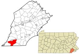
Location of East Nottingham in Chester County and Pennsylvania
|
|

Location of Pennsylvania in the United States
|
|
| Country | United States |
| State | Pennsylvania |
| County | Chester |
| Area | |
| • Total | 20.14 sq mi (52.17 km2) |
| • Land | 20.03 sq mi (51.87 km2) |
| • Water | 0.12 sq mi (0.31 km2) |
| Elevation | 499 ft (152 m) |
| Population
(2020)
|
|
| • Total | 8,650 |
| • Density | 429.5/sq mi (165.80/km2) |
| Time zone | UTC-5 (EST) |
| • Summer (DST) | UTC-4 (EDT) |
| Area code(s) | 610 |
| FIPS code | 42-029-21624 |
East Nottingham Township is a special kind of local government area called a township in Chester County, Pennsylvania, United States. In 2020, about 8,650 people lived there.
Contents
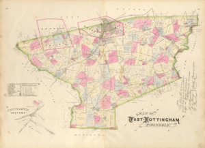
A Look Back at East Nottingham's History
This township got its name from Nottinghamshire, a place in England. Long ago, there was a disagreement about whether this area belonged to Pennsylvania or Maryland. This problem was finally solved when the famous Mason–Dixon line was drawn. This line helped set the border between the two states.
Part of the township was once a large settlement area called Susquehanna Manor. It was claimed by Maryland. This land was later named New Connaught. Many Quaker and Scotch-Irish families moved to this area during that time.
A special place called the Hopewell Historic District is located here. It is listed on the National Register of Historic Places because of its important history.
East Nottingham's Geography
East Nottingham Township covers an area of about 20.1 square miles (52.17 square kilometers). Most of this area is land, about 20.0 square miles (51.87 square kilometers). A very small part, about 0.04 square miles (0.10 square kilometers), is water.
Who Lives in East Nottingham?
In 2020, the population of East Nottingham Township was 8,982 people. This number has grown quite a bit over the years.
Here's how the population has changed:
- 1930: 1,339 people
- 1940: 1,576 people
- 1950: 1,748 people
- 1960: 2,298 people
- 1970: 2,402 people
- 1980: 3,111 people
- 1990: 3,841 people
- 2000: 5,516 people
- 2010: 8,650 people
- 2020: 8,982 people
In 2010, most people living in the township were non-Hispanic White. There were also Black or African American, Asian, and people of two or more races. About 9.2% of the people were of Hispanic or Latino background.
In 2000, there were 1,759 households in the township. Many families lived there, with 44.3% of households having children under 18. The average household had about 3 people. The median age of people living in the township was 32 years old.
Getting Around East Nottingham

East Nottingham Township has many public roads, totaling about 88 miles (141.7 kilometers) in 2022. Some of these roads are kept up by the state's Department of Transportation (PennDOT), and others are maintained by the township itself.
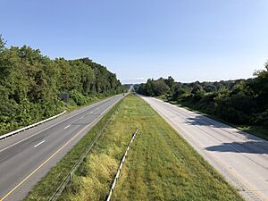
The most important road in East Nottingham Township is U.S. Route 1. This major highway runs through the western part of the township. Other important roads include Pennsylvania Route 272, which goes through the southern part, and Pennsylvania Route 472, found in the northeastern part of the township. These roads help people travel easily through the area.
See also
 In Spanish: Municipio de East Nottingham para niños
 | Emma Amos |
 | Edward Mitchell Bannister |
 | Larry D. Alexander |
 | Ernie Barnes |


