West Nottingham Township, Pennsylvania facts for kids
Quick facts for kids
West Nottingham Township
|
|
|---|---|
|
Township
|
|

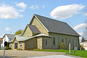
Nottingham Presbyterian Church
|
|

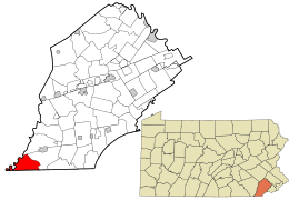
Location in Chester County and the state of Pennsylvania.
|
|

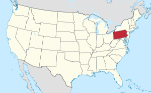
Location of Pennsylvania in the United States
|
|
| Country | United States |
| State | Pennsylvania |
| County | Chester |
| Area | |
| • Total | 14.13 sq mi (36.60 km2) |
| • Land | 13.96 sq mi (36.15 km2) |
| • Water | 0.17 sq mi (0.45 km2) |
| Elevation | 492 ft (150 m) |
| Population
(2010)
|
|
| • Total | 2,722 |
| • Estimate
(2016)
|
2,685 |
| • Density | 192.35/sq mi (74.27/km2) |
| Time zone | UTC-5 (EST) |
| • Summer (DST) | UTC-4 (EDT) |
| Area code(s) | 610 |
| FIPS code | 42-029-83712 |
West Nottingham Township is a special kind of local government area called a township. It is located in Chester County, Pennsylvania, in the United States. In 2010, about 2,722 people lived there.
Contents
A Look at West Nottingham's History
West Nottingham Township has a long and interesting past. It was officially created in 1718. However, its story goes back even further to 1701. That's when some followers of William Penn first settled in the wider Nottingham area.
How West Nottingham Got Its Name
The township is named after Nottinghamshire, a county in England. For a while, there was a disagreement about whether this land belonged to Pennsylvania or Maryland. This argument was finally settled by the Mason–Dixon line, a famous border.
Early Settlers in the Area
Because of this land dispute, many people moved to the area. These included groups like the Quakers and the Scotch-Irish. They helped shape the early community of West Nottingham.
Geography of West Nottingham
West Nottingham Township covers an area of about 13.9 square miles (36.15 square kilometers). Most of this land is dry, but a small part, about 0.04 square miles (0.1 square kilometers), is water.
Who Lives in West Nottingham?
| Historical population | |||
|---|---|---|---|
| Census | Pop. | %± | |
| 1930 | 547 | — | |
| 1940 | 685 | 25.2% | |
| 1950 | 881 | 28.6% | |
| 1960 | 1,137 | 29.1% | |
| 1970 | 1,440 | 26.6% | |
| 1980 | 2,030 | 41.0% | |
| 1990 | 2,183 | 7.5% | |
| 2000 | 2,634 | 20.7% | |
| 2010 | 2,722 | 3.3% | |
| 2020 | 2,764 | 1.5% | |
In 2010, the township had 2,722 residents. Most people living here were White (88.0%). There were also smaller groups of Black or African American people (2.0%), Native Americans (0.6%), and Asians (0.3%). About 2.0% of the population identified as being of two or more races. People of Hispanic or Latino background made up 8.3% of the total population.
Homes and Families
In 2000, there were 956 homes in the township. About 38.7% of these homes had children under 18 living in them. Many homes (57.6%) were married couples living together. The average home had about 2.75 people.
Age Groups
The median age in West Nottingham was 35 years old. This means half the people were younger than 35 and half were older. About 28.0% of the population was under 18. Around 10.1% of residents were 65 or older.
Parks and Community Life
West Nottingham is home to a special place called Nottingham County Park. This large park covers 651 acres. It sits on a unique type of rock called serpentine stone. This area is one of the biggest "serpentine barrens" on the East Coast. It's a great place to explore nature!
The township also has several communities where people live in mobile homes.
Getting Around West Nottingham
In 2009, West Nottingham Township had about 36.40 miles of public roads. The Pennsylvania Department of Transportation (PennDOT) takes care of 7.35 miles of these roads. The township itself maintains the other 29.05 miles.
Main Roads
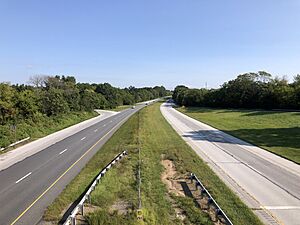
The most important highway in West Nottingham Township is U.S. Route 1. It runs north and south through the eastern part of the township. Another important road is Pennsylvania Route 272. It goes northwest to southeast through the northeastern part of the township.
See also
 In Spanish: Municipio de West Nottingham para niños
 | Dorothy Vaughan |
 | Charles Henry Turner |
 | Hildrus Poindexter |
 | Henry Cecil McBay |


