East Seaham facts for kids
Quick facts for kids East SeahamNew South Wales |
|||||||||||||||
|---|---|---|---|---|---|---|---|---|---|---|---|---|---|---|---|

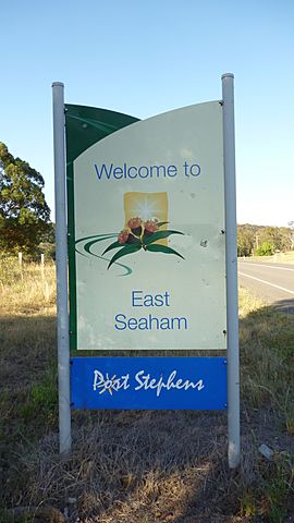
Welcome to East Seaham sign
|
|||||||||||||||
| Postcode(s) | 2324 | ||||||||||||||
| Area | 37.6 km2 (14.5 sq mi) | ||||||||||||||
| Time zone | AEST (UTC+10) | ||||||||||||||
| • Summer (DST) | AEDT (UTC+11) | ||||||||||||||
| Location |
|
||||||||||||||
| LGA(s) | Port Stephens Council | ||||||||||||||
| Region | Hunter | ||||||||||||||
| County | Gloucester | ||||||||||||||
| Parish | Wilmot | ||||||||||||||
| State electorate(s) | Port Stephens | ||||||||||||||
| Federal Division(s) | Paterson | ||||||||||||||
|
|||||||||||||||
|
|||||||||||||||
East Seaham is a quiet, mostly countryside area in the Hunter Region of New South Wales, Australia. It is part of the Port Stephens Council area. You can find East Seaham on the east side of the Williams River. Across the river are the places called Glen Oak and Seaham.
Contents
Where is East Seaham?
East Seaham is located in a beautiful part of New South Wales. It's about 178 kilometers (110 miles) north of Sydney. If you travel from Newcastle, it's about 38 kilometers (24 miles) to the north-northwest. The closest town is Raymond Terrace, which is about 13 kilometers (8 miles) north.
How Many People Live Here?
In 2011, East Seaham and the nearby area of Balickera had a total population of 359 people. This means that not many people live in a large space. The area is quite spread out, with lots of open land.
A Look Back: East Seaham's School
East Seaham has a bit of history, especially when it comes to education.
The Greswick Public School
A school called Greswick Public School was open in East Seaham for many years. It operated from 1895 until 1937. This school was important for the children of the farmers who lived and worked in the growing area around East Seaham.
Moving the Schoolhouse
Sadly, a very large bushfire happened in 1939. A bushfire is a big, uncontrolled fire that spreads quickly through forests and dry areas. After this fire, the school building from East Seaham was moved. It was taken to the nearby town of Seaham. There, it became the Seaham Public School and continued to be used until the 1960s.


