
Eastgate, Bellevue facts for kids
Quick facts for kids
Eastgate
|
|
|---|---|
|
Neighborhood
|
|

Aerial view of Eastgate
|
|

Location of Eastgate, Washington
|
|

Map of Eastgate, Washington
|
|
| Country | United States |
| State | Washington |
| County | King |
| City | Bellevue |
| Government | |
| • Type | Annexed in June, 2012 |
| Area | |
| • Total | 1.2 sq mi (3.0 km2) |
| • Land | 1.2 sq mi (3.0 km2) |
| • Water | 0 sq mi (0 km2) |
| Elevation | 400 ft (122 m) |
| Population
(2010 Census)
|
|
| • Total | 4,958 |
| • Density | 3,617/sq mi (1,396.7/km2) |
| Time zone | UTC−8 (Pacific) |
| • Summer (DST) | UTC−7 (Pacific) |
| ZIP code |
98006
|
| Area code(s) | 425 |
| FIPS code | 53-19420 |
| GNIS feature ID | 1512174 |
Eastgate is a neighborhood located in Bellevue, Washington, in the United States. In 2010, about 4,958 people lived there. Eastgate officially became part of Bellevue in 2012.
This area is known for being quite well-off. In fact, when looking at how much money people earned per person, Eastgate was ranked 38th out of 522 places in the entire state of Washington.
Contents
Eastgate's Location and Surroundings
Eastgate is a neighborhood mainly made up of homes. You can find it at these coordinates: 47°34′19″N 122°8′19″W / 47.57194°N 122.13861°W.
The neighborhood is located just south of I-90, a major highway that runs east to west. If you travel east on I-90, you'll reach Issaquah. A short drive west will take you to I-405. Eastgate is also on the side of Cougar Mountain.
Right next to Eastgate, to the west, is the area called Factoria. To the south, you'll find Somerset. The total land area of Eastgate is about 1.3 square miles (3.3 square kilometers).
Life in Eastgate: Homes and Schools
Eastgate is mostly a place where people live. It's a residential area, meaning you'll find many houses and apartments here.
The neighborhood is special because it's served by two different school districts. Students in Eastgate can attend schools within the Bellevue School District 405 or the Issaquah School District 411.
Schools in Bellevue District
- School District 405 Bellevue includes:
- Somerset Elementary
- Eastgate Elementary
- Puesta Del Sol Elementary
- Tyee Middle School
- Tillicum Middle School
- Newport High School
Schools in Issaquah District
- School District 411 Issaquah includes:
- Sunset Elementary
- Cougar Ridge Elementary
Getting Around Eastgate: Bus Routes
If you need to travel by bus in Eastgate, the King County Metro provides service. The main bus routes that serve the area are Route 241 and Route 271.
Images for kids
-
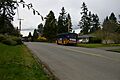
A view of Eastgate.

See also
 In Spanish: Eastgate (Washington) para niños
