El Chal, Petén facts for kids
Quick facts for kids
El Chal
|
|
|---|---|
|
Municipality
|
|
| Country | |
| Department | |
| Gazetted | 6 March 2014 |
| Seat | El Chal |
| Government | |
| • Type | Mayor–council |
| Area | |
| • Total | 957.63 km2 (369.74 sq mi) |
| Elevation
(average)
|
270 m (890 ft) |
| Population
(2018 Census)
|
|
| • Total | 13,819 |
| • Estimate
(2018)
|
15,095 |
| • Density | 14.4304/km2 (37.3746/sq mi) |
| • Seat | 2,646 (2015 estimate) |
| Time zone | UTC-6 (Central) |
| Website | Official website: https://munielchalpeten.gob.gt/web/ |
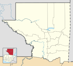
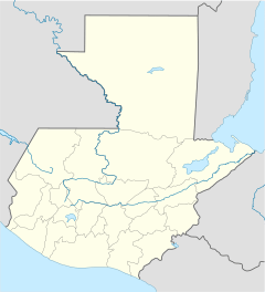
El Chal is a municipality in the Petén area of Guatemala. It is about 50 kilometers (31 miles) southeast of Flores, the capital city of Petén. The name El Chal might come from the Itzaʼ word chal, meaning "shawl," or aj-chal ja, meaning "clear water."
Contents
Where is El Chal?
El Chal is in the southern part of the Petén Basin. It shares borders with several other municipalities. These include Santa Ana to the north and Dolores to the east. To the south is Poptún, and to the west is Sayaxché. San Francisco is to the northwest. The total area of the municipality is about 957.63 square kilometers (369.74 square miles).
Land and Rivers
The land in El Chal is a bit uneven. It gets more rugged as you go towards the Maya Mountains in the southeast. Sadly, a lot of the original forest has been cut down. In 2015, over half of the land had no forest cover. Only a small part still had its original trees. A small part of the Machaquilá wildlife refuge is also in the municipality.
El Chal is part of the Pasión River system. Smaller rivers like the San Juan, Poxte, and Machaquila flow through it. These rivers always have water, but boats cannot travel on them. They also have low pollution levels. The biggest lake in El Chal is Lake Oquevix. It is on the border with Santa Ana and covers about 2.75 square kilometers (1.06 square miles). People raise Tilapia fish in this lake.
Climate
El Chal has a tropical climate. The average temperature is around 26.6 degrees Celsius (80 degrees Fahrenheit). The air is usually quite humid, between 74% and 78%. The rainy season starts in May and ends in October, with the most rain in August. El Chal gets about 1849 millimeters (72.8 inches) of rain each year.
History of El Chal
The name El Chal has been found in old records from the time of the Spanish conquest of Petén. It was once a place where travelers could stop and camp overnight. This was especially true for people traveling between Dolores and Flores.
First Settlers
The first people to try and settle in the area were the Montejo and Cuoch families in 1935. However, they later moved back to Santo Toribio. The first families to stay permanently arrived in 1948. These were the family of Sebastián Cuz and Gertrudis Pop. They also brought workers with them, whose families later joined them. In the 1950s, a road was built through El Chal. This road connected Poptún with Flores, which helped more people move to the area.
Modern Developments
After the Guatemalan Civil War, the communities of El Chal and El Quetzal worked together. They built their first water supply system between 1986 and 1987. Talks to bring electricity to the area started in 1989. However, El Chal did not get electricity until the year 2000.
El Chal officially became its own municipality on February 4, 2014. This happened after the Congress of the Republic of Guatemala made a special law. Before this, El Chal was part of the municipality of Dolores. The new law was made public on March 6, 2014.
People of El Chal
In the 2018 Guatemalan Census, El Chal had a total population of 13,819 people. The National Institute of Statistics later estimated the population to be 15,095 in 2018.
The biggest town in the municipality is also called El Chal. In 2015, about 2,646 people lived there.
Languages and Religions
Most people in El Chal, about 89%, speak Spanish as their first language. The rest of the people speak Qʼeqchiʼ. However, they can usually speak Spanish too.
When it comes to religion, the people of El Chal are almost evenly split. About 46% are Roman Catholic, and 43% are Protestant.
Culture and Traditions

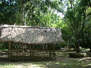
The ancient Mayan site of El Chal is located just south of the main town. This important archaeological site has been protected since 1975. The local Qʼeqchiʼ people still hold religious ceremonies there.
The most important celebration in El Chal is the feast of Saint Joseph. People have been celebrating this festival since 1969.
Economy and Daily Life
The economy of El Chal mostly depends on farming. Farmers use a method called slash-and-burn agriculture. They harvest two crops of maize (corn) and beans each year. Pumpkin seeds are also grown to sell. Other fruits and vegetables are grown on a smaller scale for local use.
Cattle farming has grown quickly in recent years. El Chal is now a leader in milk production in Petén. On average, it produces about 60,000 liters (about 15,850 gallons) of milk every day.
Transportation
The main town of El Chal is located on Central American Highway 13. This is the most important road connecting Petén to the rest of Guatemala. Other roads within the municipality are still unpaved.
See also
 In Spanish: El Chal (Petén) para niños
 | Aaron Henry |
 | T. R. M. Howard |
 | Jesse Jackson |


