Embarrass River (Minnesota) facts for kids
Quick facts for kids Embarrass River |
|
|---|---|
 |
|
|
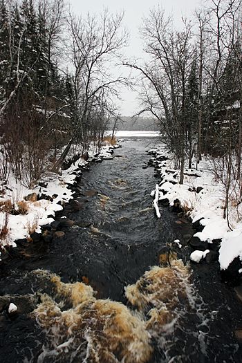
Mouth of the Embarrass River
|
|
| Country | United States |
| State | Minnesota |
| County | St. Louis County |
| Physical characteristics | |
| Main source | Babbitt 47°41′46″N 91°59′50″W / 47.6960296°N 91.9971046°W |
| River mouth | Gilbert 47°23′32″N 92°24′52″W / 47.3921512°N 92.4143509°W |
| Length | 50.5-mile-long (81.3 km) |
| Basin features | |
| River system | Saint Louis River |
The Embarrass River is a river in northern Minnesota, United States. It is about 50.5 miles (81.3 km) long. This river is a branch, or tributary, of the Saint Louis River.
Contents
About the Embarrass River
The Embarrass River starts its journey west of the city of Babbitt. It then flows mostly southwest. For a short part of its path, it turns south. This allows it to pass through a narrow space. This space is between the Embarrass Mountains to the east and the Mesabi Range to the west.
Where the River Flows
The river continues its flow until it reaches the Saint Louis River. This meeting point is southeast of Eveleth. The Saint Louis River eventually flows into Lake Superior. So, the Embarrass River's water eventually reaches Lake Superior too!
How the River Got its Name
The name "Embarrass" comes from a French word. It means "to hinder" or "to obstruct." The river was given this name because it had many obstacles. These obstacles made it hard for canoeists to travel. Imagine trying to paddle a canoe and constantly running into logs or shallow spots!
A Historic Waterway
Long ago, the Embarrass River was a very important part of a trade route. This was during the time of fur trading and early exploration. People would travel from what is now Canada, across Lake Superior. Then they would cross a special area called the "Height of Land." This is where waters flow in different directions.
From there, they would go down the Rainy River to Lake Winnipeg. This route led to the pays d'en haut. This French term means "the upper country." It referred to the areas in the Canadian northwest rich in fur-bearing animals. The Embarrass River was a key link in this long journey.
 | Georgia Louise Harris Brown |
 | Julian Abele |
 | Norma Merrick Sklarek |
 | William Sidney Pittman |


