Emigrant Pass (Oregon) facts for kids
Quick facts for kids Emigrant Pass |
|
|---|---|
| Elevation | 5,650 ft (1,722 m) |
| Location | Klamath and Lane counties, United States |
| Range | Cascade Range |
| Coordinates | 43°28′00″N 122°08′21″W / 43.46667°N 122.13917°W |
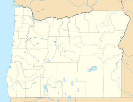
Emigrant Pass is a natural opening or "gap" in the Cascade Range mountains. This mountain range runs through the Oregon state in the United States. Emigrant Pass is located about 0.5 miles (0.8 km) west of Summit Lake. It sits right on the border between Klamath and Lane counties in Oregon.
A Name Change for Emigrant Pass
This pass was first known as Willamette Pass. It was part of a simple road that followed the Middle Fork Willamette River up towards the mountains. In 1960, the name of this gap was officially changed to Emigrant Pass. This happened because another mountain pass, used by Oregon Route 58 north of Odell Lake, was then named Willamette Pass.
Emigrants and the Oregon Trail
By the 1850s, Emigrant Pass became an important route. People moving to the Oregon Territory used it to cross the Cascade Mountains. These travelers were often called "emigrants."
In October 1853, a large group of about 1,500 emigrants faced a big problem at the pass. They were almost stuck there, which could have been very dangerous. Luckily, settlers living nearby came to their rescue. These settlers had already started making the road better along the Middle Fork Willamette River earlier that year. They hoped this route would be a quicker way between the Oregon Trail near Boise, Idaho, and the Willamette Valley. Their hard work helped save the emigrants from a terrible situation.
 | Jewel Prestage |
 | Ella Baker |
 | Fannie Lou Hamer |


