
Espino, Lares, Puerto Rico facts for kids
Quick facts for kids
Espino
|
|
|---|---|
|
Barrio
|
|

Espino barrio, coming from Caballito Sector, Lares, PR-435 junction with PR-124
|
|

Location of Espino barrio within the municipality of Lares shown in red
|
|

Espino, Lares, Puerto Rico
Location in Caribbean
|
|
| Commonwealth | |
| Municipality | |
| Area | |
| • Total | 3.19 sq mi (8.3 km2) |
| • Land | 3.19 sq mi (8.3 km2) |
| • Water | 0 sq mi (0 km2) |
| Elevation | 1,460 ft (450 m) |
| Population
(2010)
|
|
| • Total | 1,695 |
| • Density | 531.3/sq mi (205.1/km2) |
| Source: 2010 Census | |
| Time zone | UTC−4 (AST) |
Espino is a special place called a barrio in the town of Lares, Puerto Rico. Think of a barrio like a neighborhood or a district within a bigger town. In 2010, about 1,695 people lived in Espino. It's a part of Puerto Rico, which is a commonwealth of the United States.
Espino's Story
Espino has an interesting past! Long ago, in 1898, after a big event called the Spanish–American War, Spain gave Puerto Rico to the United States. This meant Puerto Rico became a territory of the U.S.
Soon after, in 1899, the United States government did a count of all the people in Puerto Rico. This count, called a census, found that 1,148 people lived in Espino barrio at that time. Over the years, the number of people living in Espino has changed. You can see how the population grew and shrank over time in the chart below.
| Historical population | |||
|---|---|---|---|
| Census | Pop. | %± | |
| 1900 | 1,148 | — | |
| 1980 | 1,638 | — | |
| 1990 | 1,591 | −2.9% | |
| 2000 | 1,932 | 21.4% | |
| 2010 | 1,695 | −12.3% | |
| U.S. Decennial Census 1899 (shown as 1900) 1910-1930 1930-1950 1980-2000 2010 |
|||
Exploring Espino's Neighborhoods
Barrios like Espino are often divided into even smaller areas. These smaller parts are called sectores (say: sek-TOR-es), which means "sectors" in English. These sectors can have different names, like urbanización (a type of housing development) or barriada (another kind of neighborhood).
Here are some of the different sectors you can find within Espino barrio:
Arco Iris, Berrocal, Camino Caballito, Camino David González, Camino Emau, Camino Herminio Hernández, Camino Julito Nieves, Carmelo Mercado, Copa de Oro, Demetrio Otaño, El Maná, Las Lajas, Los Adames, Los Chayotes, Los Luciano, Los Otaño, Parcelas Tabonuco, Sector Ceiba, Sector Cheíto Vega, Sector Justo Malo, Sector La Cabaña, Sector Mameyes, Sector Milito Méndez, Sector Oliver, Sector Raty Guivas, Sector Tellado, Sector Toño Vega, Sector Trofy Lares, Tramo Carretera 124 (Lado este desde la Ferretería Los Muchachos hasta la residencia del señor Juanma Collazo), Tramo Carretera 124 (Parte oeste desde el negocio Rincón de los Trovadores hasta el Garage de Pepito Collazo), Tramo Carretera 436, and Urbanización Brisas de Lares.
Pictures of Espino
-
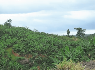
Vegetation in Espino barrio, Lares; view from PR-435 near PR-124 junction.
-
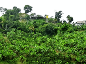
Homes in Espino barrio, Lares; view from PR-435 near PR-124 junction.


Want to Learn More?
 In Spanish: Espino (Lares) para niños
- List of communities in Puerto Rico
- List of barrios and sectors of Lares, Puerto Rico
