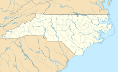
Eureka, North Carolina facts for kids
Quick facts for kids
Eureka, North Carolina
|
|
|---|---|
| Country | United States |
| State | North Carolina |
| County | Wayne |
| Area | |
| • Total | 0.34 sq mi (0.89 km2) |
| • Land | 0.34 sq mi (0.89 km2) |
| • Water | 0.00 sq mi (0.00 km2) |
| Elevation | 125 ft (38 m) |
| Population
(2020)
|
|
| • Total | 214 |
| • Density | 625.73/sq mi (241.74/km2) |
| Time zone | UTC-5 (Eastern (EST)) |
| • Summer (DST) | UTC-4 (EDT) |
| ZIP code |
27830
|
| Area code(s) | 919 |
| FIPS code | 37-21960 |
| GNIS feature ID | 2406469 |
Eureka is a small town in Wayne County, North Carolina, in the United States. In 2010, about 197 people lived there. It is part of the larger Goldsboro area.
Contents
History of Eureka
Eureka was first started in 1879. Back then, it was called Saul's Cross Roads. In 1901, its name was officially changed to Eureka.
Important Buildings and Events
The Eureka United Methodist Church is a very old building. It was added to the National Register of Historic Places in 1982. This means it is an important historical site.
On January 24, 1961, a large B-52 bomber plane crashed near Eureka. This plane was carrying two very powerful nuclear bombs. Luckily, both bombs were found. However, one part of a bomb, made of uranium, was lost in the ground. It is still buried there today. A sign in the town tells the story of this event.
In 2019, the state government of North Carolina stepped in to help Eureka. The town needed help with its sewer system and money matters. So, the state took over managing the town's finances and administration. This help is planned to continue until at least June 30, 2024.
Geography of Eureka
Eureka is a small town. According to the United States Census Bureau, the town covers about 0.4 square miles (0.89 square kilometers). All of this area is land, with no water.
People of Eureka
| Historical population | |||
|---|---|---|---|
| Census | Pop. | %± | |
| 1900 | 123 | — | |
| 1910 | 162 | 31.7% | |
| 1920 | 187 | 15.4% | |
| 1930 | 198 | 5.9% | |
| 1940 | 194 | −2.0% | |
| 1950 | 192 | −1.0% | |
| 1960 | 246 | 28.1% | |
| 1970 | 263 | 6.9% | |
| 1980 | 303 | 15.2% | |
| 1990 | 282 | −6.9% | |
| 2000 | 244 | −13.5% | |
| 2010 | 197 | −19.3% | |
| 2020 | 214 | 8.6% | |
| U.S. Decennial Census | |||
In the year 2000, 244 people lived in Eureka. There were 108 homes, and 72 of these were families. Most people living in Eureka were White (about 76%). About 24% were African American. A small number, about 4%, were Hispanic or Latino.
About 19% of the people were under 18 years old. About 24% were 65 years or older. The average age in the town was 45 years old.
Education in Eureka
Children in Eureka go to schools that are part of the Wayne County Public School system. These schools are usually in nearby towns. For students who want to continue their education after high school, Wayne Community College is available in Goldsboro.
Transportation in Eureka
Getting Around by Air
- Local Airport: The closest airport with flights for passengers is Kinston Regional Jetport. You can fly from there to Orlando, Florida.
- Major Airport: For more flight options, including international trips, people usually go to Raleigh-Durham International Airport. It has flights to over 45 places.
- Small Airport: There is also Goldsboro-Wayne Municipal Airport nearby. This airport is mainly used for private planes, not regular passenger flights.
Getting Around by Road
- Interstate Highway: The closest major highway is I-795. It is about 6.5 miles west of Eureka, near the town of Fremont.
- Main Highways: The two main roads that go through Eureka are NC 111 and NC 222.
Getting Around by Train and Bus
- Trains: Eureka does not have its own passenger train station. The closest Amtrak train station is in Wilson.
- Buses: You can find bus services provided by Greyhound in nearby Goldsboro.
See also
 In Spanish: Eureka (Carolina del Norte) para niños
 | Delilah Pierce |
 | Gordon Parks |
 | Augusta Savage |
 | Charles Ethan Porter |


