Evaro, Montana facts for kids
Quick facts for kids
Evaro, Montana
|
|
|---|---|

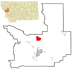
Location in Missoula County and the state of Montana
|
|
| Country | United States |
| State | Montana |
| County | Missoula |
| Area | |
| • Total | 17.16 sq mi (44.45 km2) |
| • Land | 17.16 sq mi (44.43 km2) |
| • Water | 0.01 sq mi (0.01 km2) |
| Elevation | 3,960 ft (1,207 m) |
| Population
(2020)
|
|
| • Total | 373 |
| • Density | 21.74/sq mi (8.40/km2) |
| Time zone | UTC-7 (Mountain (MST)) |
| • Summer (DST) | UTC-6 (MDT) |
| ZIP codes | |
| Area code(s) | 406 |
| FIPS code | 30-25000 |
| GNIS feature ID | 0783256 |
Evaro is a small community in Missoula County, Montana, United States. It is known as a census-designated place (CDP). This means it's an area that the U.S. Census Bureau defines for gathering population data, even though it's not an officially incorporated town.
Evaro is part of the Missoula metropolitan area. It is located about 20 miles (32 km) north of downtown Missoula. You can reach it by taking US Highway 93. This community is also found on the southern edge of the Flathead Indian Reservation. In 2020, the population of Evaro was 373 people. This was an increase from 322 people in 2010.
Contents
Geography of Evaro
Evaro is located in the north-central part of Missoula County. There is also an older, unincorporated community named Evaro. This older area is about 3 miles (5 km) southwest of the CDP.
Land and Water Features
The Evaro CDP covers a total area of about 17.2 square miles (44.5 square kilometers). Most of this area is land, with only a very small part being water.
Finley Creek and its smaller stream, Schley Creek, flow through the community. These creeks drain water to the north. Finley Creek then flows into the Jocko River. The Jocko River travels northwest and joins the Flathead River near Dixon.
Evaro Hill's Local Name
South of Evaro, there is a place called Evaro Hill. The Salish people have a special name for this hill. They call it snɫp̓upƛ̓m or snɫp̓u. This name means "small clearing on the hilltop."
Population and People
Evaro has seen its population change over the years. Here's how the number of people living there has grown:
| Historical population | |||
|---|---|---|---|
| Census | Pop. | %± | |
| 2000 | 329 | — | |
| 2010 | 322 | −2.1% | |
| 2020 | 373 | 15.8% | |
| U.S. Decennial Census | |||
In 2000, there were 329 people living in Evaro. These people lived in 110 households, with 84 of them being families. The community had about 19 people per square mile (7.4 people per square kilometer).
Many different groups of people live in Evaro. In 2000, about 48% of the people were White. About 45% were Native American. A small number were Pacific Islander or from two or more racial backgrounds. About 10% of the population was Hispanic or Latino.
The community has a mix of ages. In 2000, about 33% of the people were under 18 years old. About 29% were between 25 and 44 years old. The average age in Evaro was 31 years.
Education in Evaro
Most of the children in Evaro attend schools in the Arlee Elementary School District and the Arlee High School District. These districts serve students from kindergarten through high school.
A smaller part of Evaro is in a different school district. This area is served by the Frenchtown K-12 Schools. This district also provides education for students from kindergarten all the way through 12th grade.
See also
 In Spanish: Evaro (Montana) para niños
 | Emma Amos |
 | Edward Mitchell Bannister |
 | Larry D. Alexander |
 | Ernie Barnes |

