Fairfield Township, Butler County, Ohio facts for kids
Quick facts for kids
Fairfield Township, Butler County, Ohio
|
|
|---|---|

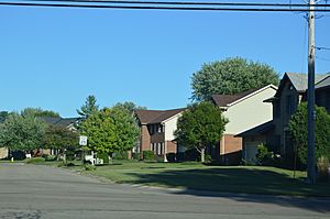
Saratoga Drive, a typical suburban street in the township.
|
|

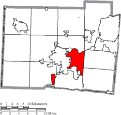
Location of Fairfield Township in Butler County
|
|
| Country | United States |
| State | Ohio |
| County | Butler |
| Established | 1795 |
| Government | |
| • Type | Board of Trustees |
| Area | |
| • Total | 50 sq mi (130 km2) |
| Elevation | 2,369 ft (722 m) |
| Population
(2020)
|
|
| • Total | 22,645 |
| Time zone | UTC-5 (Eastern (EST)) |
| • Summer (DST) | UTC-4 (EDT) |
| GNIS feature ID | 1085808 |
| Website | http://www.fairfieldtwp.org/ |
Fairfield Township is a place in Butler County, Ohio, United States. It is one of 13 townships in the county. You can find it in the south-central part of Butler County. In 2020, about 22,645 people lived there. It used to be about 50 square miles big. But parts of it were later added to the nearby cities of Hamilton and Fairfield.
Contents
What's in a Name?
Fairfield Township got its name because the land there is mostly flat and pleasant. The name "Fairfield" means a beautiful, open area. There are actually seven different townships named Fairfield in Ohio!
A Look Back in Time: Fairfield's History
Fairfield Township was created a long time ago in 1795. This happened after the Treaty of Greenville was signed. This treaty helped set up peace between Native American tribes and the United States.
At that time, a court in Hamilton County decided to create two new townships: Springfield and Fairfield. These new areas were formed from the northern parts of Cincinnati Township.
A few years later, in 1802, Fairfield Township became part of the newly formed Butler County.
For a short time in 1994 and 1995, the township tried to become its own city called Indian Springs. This was allowed by a special law. However, a court later said this law was not allowed by the state's rules. So, Fairfield Township went back to being a township.
Where is Fairfield Township?
Fairfield Township is located in the southern part of Butler County. It shares borders with several other townships and cities.
- St. Clair Township is to the north, across the Great Miami River.
- Madison Township is to the northeast.
- Liberty Township is to the east, north of West Chester Township.
- West Chester Township is also to the east, but south of Liberty Township.
- The city of Fairfield is to the south.
- Ross Township is to the southwest.
- The city of Hamilton is to the west.
- The village of New Miami is to the northwest.
The Great Miami River flows through the area. Over time, the river has changed its path a bit. Because of this, some parts of the township are now west of the river. The lowest point in all of Butler County is in Fairfield Township. This spot is about 520 feet above sea level. It is where the Great Miami River leaves Butler County.
Getting Around: Transportation
Fairfield Township has been important for travel for a long time.
- Canals and Railroads: The Miami and Erie Canal used to run through the township. It connected cities like Cincinnati and Hamilton. Later, the Cincinnati, Hamilton and Dayton Railroad also built its main line through the township. Today, this railroad is part of CSX Transportation.
- Major Roads: Important roads help people travel through Fairfield Township.
- State Route 4 is a main road connecting Hamilton and Middletown.
- The Butler County Regional Highway, also known as State Route 129, is another key route.
- U.S. Route 127 goes south towards Cincinnati. It passes through Hamilton, which is just west of the township.
See also
 In Spanish: Municipio de Fairfield (condado de Butler) para niños
 | John T. Biggers |
 | Thomas Blackshear |
 | Mark Bradford |
 | Beverly Buchanan |

