Falls Creek (California) facts for kids
Quick facts for kids Falls Creek |
|
|---|---|

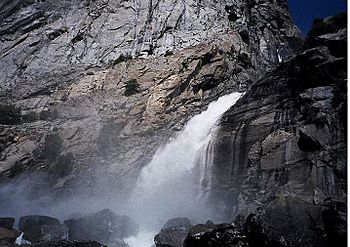
One of the several tiers of Wapama Falls
|
|
| Country | United States |
| State | California |
| Region | Yosemite National Park |
| Physical characteristics | |
| Main source | Dorothy Lake 9,500 ft (2,900 m) 38°10′10″N 119°35′43″W / 38.16944°N 119.59528°W |
| River mouth | Hetch Hetchy Reservoir 3,783 ft (1,153 m) 37°57′47″N 119°45′55″W / 37.96306°N 119.76528°W |
| Length | 24 mi (39 km) |
| Basin features | |
| Basin size | 100 sq mi (260 km2) |
| Tributaries |
|
Falls Creek, also known as the Falls River, is a cool stream in Yosemite National Park, California. It's a branch of the Tuolumne River. This creek is famous for its two big waterfalls. It also has many trails for hikers to enjoy.
Where Does Falls Creek Flow?

Falls Creek starts at Dorothy Lake. This lake is in the northern part of Yosemite National Park. The creek begins high up, at about 10,000 feet (3,000 m) (3,000 meters) above sea level. It flows between tall mountains like Forsyth Peak and Bigelow Peak.
The creek then drops into Jack Main Canyon. It flows alongside the Pacific Crest Trail. This famous trail follows the creek south. Another creek, Tilden Creek, joins Falls Creek here.
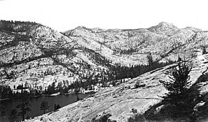
Falls Creek then passes Branigan Lake. It tumbles down into a basin. This basin holds Lake Vernon, which the creek flows into. After leaving Lake Vernon, the creek heads southwest. It gets closer to Hetch Hetchy Reservoir.
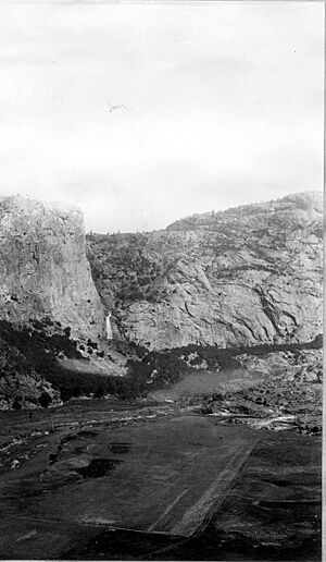
Near its end, Falls Creek flows past Hetch Hetchy Dome. It then splits into two smaller streams. Both of these streams create amazing waterfalls. These are Wapama Falls and Tueeulala Falls. They are near Hetch Hetchy Dome.
What Is the Falls Creek Area Like?
The area around Falls Creek is called its watershed. A watershed is all the land where water drains into a specific river or lake. The Falls Creek watershed is about 100 square miles (260 km2) (260 square kilometers). It is in the northern part of Yosemite National Park.
This area is long and narrow. It stretches about 18 miles (29 km) (29 kilometers) from north to south. At its widest, it's about 2 miles (3.2 km) (3.2 kilometers) across. The land here was shaped by glaciers long ago. It has many granite bowls and hills called moraines.
Many lakes are found in this watershed. Some are named, like Dorothy, Mary, Tilden, Wilma, and Vernon lakes. The creek flows all year round. When snow melts, it can cause a lot of water to flow. This sometimes floods bridges near its mouth.
Exploring Falls Creek: Trails and Fun
Falls Creek is a great place for hiking. Trails follow the creek for most of its journey. The Pacific Crest Trail starts near Dorothy Pass. It follows the creek south from its beginning.
Later, the Pacific Crest Trail turns east. But another trail continues to follow the creek southwest. This trail leads to the end of the canyon. From there, it climbs up a ridge west of the creek.
Another trail starts from the west side of Hetch Hetchy Valley. It goes above the area where Falls Creek and Eleanor Creek separate. Eleanor Creek flows into Lake Eleanor. This trail then loops down to Lake Vernon. There's also an unofficial trail. It goes from Lake Vernon to the top of Wapama Falls.
There are two ranger stations near Falls Creek. One is at Wilma Lake, and the other is at Lake Vernon. These stations help park rangers keep the area safe. There are no special campsites along Falls Creek. This means you need to plan your trips carefully.
 | Jewel Prestage |
 | Ella Baker |
 | Fannie Lou Hamer |


