Farm Island Township, Aitkin County, Minnesota facts for kids
Quick facts for kids
Farm Island Township
|
|
|---|---|
|
Township
|
|

Dorris Church altar
|
|
| Country | United States |
| State | Minnesota |
| County | Aitkin |
| Area | |
| • Total | 35.7 sq mi (92.5 km2) |
| • Land | 28.4 sq mi (73.5 km2) |
| • Water | 7.3 sq mi (19.0 km2) |
| Elevation | 1,257 ft (383 m) |
| Population
(2010)
|
|
| • Total | 1,099 |
| • Density | 39/sq mi (14.9/km2) |
| Time zone | UTC-6 (Central (CST)) |
| • Summer (DST) | UTC-5 (CDT) |
| FIPS code | 27-20654 |
| GNIS feature ID | 0664148 |
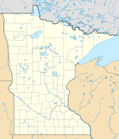
Farm Island Township is a community located in Aitkin County, Minnesota, United States. In 2010, the population of the township was 1,099 people. It is known for its beautiful natural areas and many lakes.
Contents
What's in a Name? Farm Island
Farm Island Township gets its name from a special island in Farm Island Lake. Long ago, the Ojibwe people used to grow crops on this island. It was like a farm, which is how the lake and the township got their unique name!
A Look Back: Farm Island's History
From 1896 to 1912, Farm Island had a post office called Dorris. Because of this, some people still call the area Dorris today. The historic Cedar Lake Lutheran Church and its nearby cemetery are also known by the name Dorris.
Early families who moved to the area included the Roms (also known as Carlsons), Dummers, Rudes (or Ruds), and Petersons. For many years, the Rom family ran a poultry farm, but they stopped their egg business in 2006.
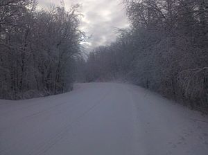
Much of the land in the township was first given to the railroad. Later, the railroad sold the land to settlers who wanted to live there. The landscape reminded early surveyors of Switzerland, so they named a path the Switzerland Trail. Today, this is known as Township Road 96.
Pine-Hickory Lakes Roadside Parking Area
A special place called the Pine-Hickory Lakes Roadside Parking Area was built between 1937 and 1938. This project was part of the New Deal, a group of programs created by the U.S. government to help people during the Great Depression. This parking area is now listed on the National Register of Historic Places because of its historical importance.
Exploring Farm Island's Geography
Farm Island Township covers a total area of about 92.5 square kilometers (35.7 square miles). Most of this area, about 73.5 square kilometers (28.4 square miles), is land. The rest, about 19.0 square kilometers (7.3 square miles), is water, mostly from its many lakes. The land here looks different from many other parts of Aitkin County.
Major Highway
Lakes in Farm Island
Farm Island Township is home to many beautiful lakes. Here are some of them:
- Anderson Lake
- Apple Lake
- Bachelor Lake
- Black Shadow Lake
- Blue Lake (south three-quarters)
- Brennen Lake
- Camp Lake
- Carlson Lake
- Cedar Lake (southeast half)
- Christmas Lake
- Diamond Lake
- Drain Lake
- Dummer Lake
- Farm Island Lake (north three-quarters)
- Hammal Lake
- Hanging Kettle Lake
- Hickory Lake
- Hill Lake
- Horseshoe Lake
- Landgren Lake
- Little Pete Lake
- Little Pine Lake
- Lake Four
- Lake Three
- Long Lake
- Pine Island Lake
- Prescott Lake
- Ripple Lake (west edge)
- Round Lake
- Seth Lake (west edge)
- Spirit Lake
- Sunset Lake
- Taylor Lake
- Thornton Lake
- Town Line Lake
- Townhall Lake
- Vorse Lake
Nearby Townships
Farm Island Township shares its borders with several other townships:
- Aitkin Township (to the north)
- Spencer Township (to the northeast)
- Nordland Township (to the east)
- Wealthwood Township (to the southeast)
- Hazelton Township (to the south)
- Bay Lake Township, Crow Wing County (to the southwest)
- Deerwood Township, Crow Wing County (to the west)
- Rabbit Lake Township, Crow Wing County (to the northwest)
Cemeteries
The township has two cemeteries: Diamond Lake Cemetery and Dorris Cemetery.
Who Lives Here? Farm Island Demographics
According to the census from 2000, there were 1,071 people living in Farm Island Township. These people lived in 434 households, and 335 of these were families.
The average household had about 2.47 people, and the average family had about 2.79 people. The population was spread out by age:
- 21.5% were under 18 years old.
- 5.5% were between 18 and 24.
- 20.4% were between 25 and 44.
- 32.9% were between 45 and 64.
- 19.7% were 65 years old or older.
The average age of people in the township was 47 years.
See also
 In Spanish: Municipio de Farm Island para niños
 | Leon Lynch |
 | Milton P. Webster |
 | Ferdinand Smith |


