Farmington Canal Heritage Trail facts for kids

The Farmington Canal Heritage Trail is a super long path, about 81.2 miles (130.7 km) long, where you can walk, bike, or even run! It stretches through Connecticut and Massachusetts.
This trail was built on the old path of a railroad, which itself was built along an even older canal. The canal was called the Farmington Canal in Connecticut and the Hampshire and Hampden Canal in Massachusetts.
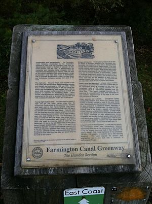
Parts of the trail, from New Haven to Tariffville, are part of a much bigger path called the East Coast Greenway. This huge trail is planned to connect Maine all the way to Florida!
Contents
A Path Through History
Back in 1821, some smart business people in New Haven wanted to build a canal, just like the famous Erie Canal in New York. It took them ten years, and the canal opened in 1835. But just twelve years later, trains became a much better way to move goods and people. So, a railroad track was built right along the same path the canal used to follow.
Over the years, many different companies owned this railroad line. Eventually, in the 1980s, the last company stopped using parts of the line. The Connecticut Department of Transportation then bought most of it. They wanted to "railbank" it, which means saving the old railroad land so it could be turned into trails later. In 1991, a special law helped states get money to turn these old railroad paths into fun trails for everyone to use.
Today, the trail goes from downtown New Haven, Connecticut, all the way to Northampton, Massachusetts. It follows the original canal path and Route 10 very closely.
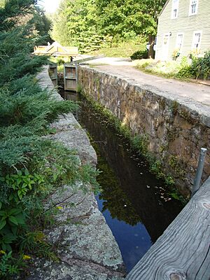
You can still see parts of the old canal along the trail! There's an old "lock house" (a building where canal workers lived) and even "canal locks." Locks were like elevators for boats, helping them move up and down different water levels. In Cheshire, Connecticut, there's a special spot called Lock 12 Historical Park. It has the only restored canal lock from the original canal line.
Where is the Trail Now?
The Farmington Canal Heritage Trail isn't completely finished yet. About 85% of it is done in Connecticut, and 63% is finished in Massachusetts. The trail is divided into three main parts:
Southern Section
As of October 2018, you can ride or walk a continuous part of the trail for 25 miles. This section goes from Yale University to Lazy Lane in Southington. The northern part of Southington is being worked on. There's still a gap of about 5.3 miles through Plainville that needs to be completed.
Middle Section
As of October 2018, this part of the trail is mostly finished. It runs without interruption for 24.6 miles. You can go from Northwest Drive in Northern Plainville all the way to the Massachusetts border in Suffield.
Northern Section
As of October 2018, the trail in Southwick, Massachusetts, is complete. The trail in Westfield is also finished up to Main Street, making up 8.5 miles. There's a gap of 8.4 miles between Westfield and Southampton. The rest of the trail is complete from Easthampton into Northampton, which is another 7.3 miles.
Farmington Canal State Park Trail
A big part of the Farmington Canal Heritage Trail is inside the Farmington Canal State Park Trail. This park is in the towns of Cheshire and Hamden. Long ago, the native Quinnipiac tribes used this path. Later, colonists made it into a road.
The canal project started on July 4, 1825. The first parts of the canal opened in 1828. But the canal companies ran into money problems. In 1847, people who invested in the company asked the state if they could build a railroad instead. The railroad was built in just one year, right next to the canal. Trains used this line until the 1980s.
In 1992, a group called the Farmington Valley Trails Council was formed. They wanted to save the old canal path by turning it into a park. A part of the Farmington Canal State Park trail officially opened on May 22, 1994. You can find Lock 12 Historical Park on North Brooksvale Road. It has a restored canal lock and a museum. It's known as the "best-preserved relic of Connecticut's canal era." The developed part of the trail within the state park is about 17.7 miles (28.5 km) long. It goes south from Hart Street in Southington to Todd Street in Hamden.
 | Aurelia Browder |
 | Nannie Helen Burroughs |
 | Michelle Alexander |


