
Pleasure Island (North Carolina) facts for kids

Pleasure Island is a cool coastal island in Southeastern North Carolina, USA. It's just south of the city of Wilmington. This island is part of New Hanover County. You'll find the fun beach towns of Carolina Beach and Kure Beach here. Also, the areas of Wilmington Beach and Hanby Beach are on the island.
Long ago, the southern part of Pleasure Island was separate from Bald Head Island. They were divided by a water channel called Corncake Inlet. But in 1998, Hurricane Bonnie filled in this channel with sand. Now, Pleasure Island and Bald Head Island are connected. They form one long piece of land.

The combined island now stretches from Carolina Beach Inlet in the north. The Cape Fear River is to its west, and the Atlantic Ocean is to its east and south. This long island is about 17 miles (27 km) long. It's 2 miles (3.2 km) wide in the north and 3 miles (4.8 km) wide in the south. In the middle, it's only about half a mile (0.8 km) wide. At the very southeastern tip of this island is a point called Cape Fear. From this point, dangerous sandbars called Frying Pan Shoals stick out 30 miles (48 km) into the ocean. These shoals form where ocean currents and river water meet.
The name "Pleasure Island" usually refers to the northern part of this combined island. This is the part located in New Hanover County. The southern part, in Brunswick County, is known as Bald Head Island.

Before 1931, the land that is now Pleasure Island was a long, narrow strip of land. It was called Federal Point. This strip stretched from Myrtle Grove to Fort Fisher. A lighthouse, the Federal Point Light, once stood at the southern end of this land. In 1931, a man-made canal called Snows Cut was built. This canal separated Federal Point from the mainland, creating Pleasure Island.
You can reach Pleasure Island by car using U.S. Highway 421. This is the only road that crosses a bridge to the island. At the very end of Route 421, at Fort Fisher, you can take a ferry. This ferry connects Pleasure Island to Southport, North Carolina. There's another ferry from Southport that goes to Bald Head Island. There are no roads between Pleasure Island and Bald Head Island. But park rangers, people on fat-tire bikes, and walkers can travel along the beach to get between them.
Pleasure Island has a unique 11-acre freshwater lake. It's fed by springs and is less than 200 yards (180 m) from the salty ocean! This lake was once called "The Freshwater Lake." Now, it's known as "Carolina Beach Lake." The name "Pleasure Island" was created in 1972. Local business groups came up with it to give the area a positive, fun name.
Contents
Exploring Pleasure Island
Pleasure Island is part of a long, sandy beach that stretches for 20 miles (32 km). This beach goes from Carolina Beach Inlet in the north, south to the county line, and then west to the mouth of the Cape Fear River.
Fun Things to Do on Pleasure Island
There are many exciting places to visit and activities to enjoy on Pleasure Island.
Parks and Nature Areas
- Fort Fisher State Recreation Area: A great spot for history and nature.
- Carolina Beach State Park: This park has a marina and places for camping. You can also hike to the Sugar Loaf Sand Dune, which is about 50 feet (15 m) high! The park is also home to cool carnivorous plants.
- Joe Eakes Park: Here you can find a disc golf course.
- Mike Chappell Park: This park has a skateboard park and a dog park.
- Freeman Park: Located at the north end of Carolina Beach, this park allows four-wheel-drive vehicles on the beach. You can also have beach campfires and camp overnight here.
- Carolina Beach Lake Park: A lovely park around the freshwater lake.
Piers and Aquariums
- North Carolina Aquarium at Fort Fisher: A fantastic place to learn about ocean life.
- Kure Beach Pier: A popular spot for fishing and enjoying ocean views.
- Carolina Beach Pier: Another great pier for fishing and fun.
Wildlife on Pleasure Island

Pleasure Island is home to many different animals. You might see white-tailed deer, red foxes, and coyotes. The island is also a haven for many types of birds and fish. Sometimes, whales even visit in the winter!
Sea Turtles and Other Marine Life
Every year, dozens of sea turtles make their nests on the island's beaches. These nests are carefully watched by the Pleasure Island Sea Turtle Project. Loggerhead turtles are the most common type of sea turtle seen here. But you might also spot green, leatherback, Ridley, and hawksbill turtles.

Pleasure Island is also close to two important nature reserves. These are part of the North Carolina National Estuarine Research Reserve. To the north is Masonboro Island, which is over 5,000 acres (2,000 ha). To the south is Zeke's Island, which is over 1,100 acres (450 ha). These reserves protect important coastal habitats.

Images for kids
-
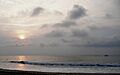
Sunrise over Pleasure Island.

